Back Ras Xafun burnu Azerbaijani Хафун Bulgarian Rt Hafun BS Hafun Catalan Hafun Czech Hafun Welsh Ras Hafun German Ρας Χαφούν Greek Cabo Hafun Spanish Xaafuuni poolsaar Estonian
Ras Hafun
Capo Hafun Cape Hafun | |
|---|---|
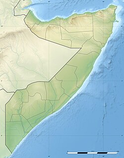
 Hafun juts out to the east of the mid-Bari region | |
| Coordinates: 10°25′0″N 51°16′0″E / 10.41667°N 51.26667°E | |
| Location | Horn of Africa |
| Area | |
| • Total | 2,571 km2 (993 sq mi) |
| Dimensions | |
| • Length | 1,100 m (3,600 ft) |
Ras Hafun (Somali: Ras Xaafuun, Arabic: رأس حافون, Italian: Capo Hafun), also known as Cape Hafun, is a promontory in the northeastern Bari region of the Puntland state in Somalia. Jutting out into the Guardafui Channel, it constitutes the easternmost point in Africa. The area is situated near the Cape Guardafui headland. It is joined to the mainland at the town of Foar, by a sand spit 20.0 km (12.4 mi) long, 1.0–3.0 km (0.62–1.86 mi) in width, and 5.0 m (16.4 ft) above sea level. The fishing town of Hafun is located on the promontory, 2.0 km (1.2 mi) east of the sand spit.
Ras Hafun and its line of latitude separate the Guardafui Channel to its north, from the Somali Sea to its south.
© MMXXIII Rich X Search. We shall prevail. All rights reserved. Rich X Search
