Back Regional Municipality of Niagara CEB Regional Municipality of Niagara German Municipalidad Regional de Niágara Spanish شهرستان نایاگارا Persian Municipalité régionale de Niagara French אזור ניאגרה HE Municipalità Regionale di Niagara Italian ナイアガラ地域 Japanese ნიაგარის რეგიონალური მუნიციპალიტეტი Georgian 나이아가라 지방자치구 Korean
Niagara Region | |
|---|---|
| Regional Municipality of Niagara | |
| Motto(s): Unity, Responsibility, Loyalty | |
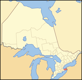
 Location of Niagara within Ontario | |
| Coordinates: 43°02′33″N 79°18′02″W / 43.04250°N 79.30056°W[1] | |
| Country | Canada |
| Province | Ontario |
| Formed | 1970 (from Welland and Lincoln Counties) |
| Seat | Thorold |
| Government | |
| • Chair | Jim Bradley |
| • Governing body | Niagara Regional Council |
| • MPs | Dean Allison, Chris Bittle, Vance Badawey, Tony Baldinelli |
| • MPPs | Jeff Burch, Wayne Gates, Sam Oosterhoff, Jennie Stevens |
| Area | |
| • Land | 1,854.23 km2 (715.92 sq mi) |
| Population (2016)[2] | |
| • Total | 447,888 |
| • Density | 241.5/km2 (625/sq mi) |
| Gross Metropolitan Product | |
| • St. Catharines – Niagara CMA | CA$17.4 billion (2020)[3] |
| Time zone | UTC−05:00 (EST) |
| • Summer (DST) | UTC−04:00 (EDT) |
| Website | www.niagararegion.ca |
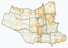
The Regional Municipality of Niagara, also colloquially known as the Niagara Region or Region of Niagara, is a regional municipality comprising twelve municipalities of Southern Ontario, Canada. The regional seat is in Thorold. It is the southern end of the Golden Horseshoe, the largest megalopolis in Canada.
The region occupies most of the Niagara Peninsula. Its eastern boundary is the Niagara River, which is also the border with the US state of New York. It is bounded on the north by Lake Ontario and on the south by Lake Erie.
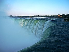
Unique natural landscapes make the Niagara Region an important centre for agriculture and tourism in Canada. The most important agricultural enterprise in Niagara is viticulture, or winemaking. The Niagara Wine Route, which connects visitors to dozens of wineries, is a growing tourism draw while the internationally renowned Niagara Falls is one of Canada's major tourist attractions. Along with Shaw Festival, held annually in Niagara-on-the-Lake, and the Welland Canal, the Regional Municipality of Niagara receives up to 12 million visitors each year.
Niagara Region is situated on treaty land. This land has a rich history of First Nations such as the Neutral, the Haudenosaunee, and the Anishinaabe, including the Mississaugas of the Credit First Nation.[4] There are many First Nations, Métis, and Inuit people from across Turtle Island that continue to live and work in Niagara today.
- ^ "Regional Municipality of Niagara". Geographical Names Data Base. Natural Resources Canada.
- ^ a b "Census Profile, 2016 Census Niagara, Regional municipality". Statistics Canada. Retrieved July 2, 2019.
- ^ "Gross domestic product (GDP) at basic prices, by census metropolitan area (CMA)". statcan.gc.ca.
- ^ "Subject: Updated Land Acknowledgement Statements". Regional Municipality of Niagara publications. August 26, 2021. Retrieved May 8, 2023.
© MMXXIII Rich X Search. We shall prevail. All rights reserved. Rich X Search


