Back نهر ويندروش ARZ River Windrush BAR River Windrush CEB River Windrush German Windrush Finnish Windrush (rivière) French Windrush (rivier) Dutch Windrush (rzeka) Polish River Windrush Swedish
| Windrush | |
|---|---|
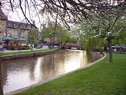
 The Windrush at Bourton-on-the-Water | |
| Location | |
| Country | England |
| Counties | Gloucestershire, Oxfordshire |
| Towns | Bourton-on-the-Water, Burford, Witney |
| Physical characteristics | |
| Source | |
| • location | Gloucestershire, Cotswold Hills |
| • coordinates | 51°58′54.51″N 1°51′59.64″W / 51.9818083°N 1.8665667°W |
| Mouth | River Thames |
• location | Newbridge |
• coordinates | 51°42′36.03″N 1°25′7.19″W / 51.7100083°N 1.4186639°W |
| Length | 65 km (40 mi) |
| Discharge | |
| • location | Newbridge |
| • average | 3.27 m3/s (115 cu ft/s) |
| • minimum | 0.11 m3/s (3.9 cu ft/s)26 August 1976 |
| • maximum | 21.6 m3/s (760 cu ft/s)6 December 1960 |
| Discharge | |
| • location | Worsham |
| • average | 2.40 m3/s (85 cu ft/s) |
| Discharge | |
| • location | Bourton-on-the-Water |
| • average | 1.20 m3/s (42 cu ft/s) |
The River Windrush is a tributary of the River Thames in central England. It rises near Snowshill in Gloucestershire and flows south east for 65 km (40 mi) via Burford and Witney to meet the Thames at Newbridge in Oxfordshire.
The river gives its name to the village of Windrush in Gloucestershire.
© MMXXIII Rich X Search. We shall prevail. All rights reserved. Rich X Search