Roe Street | |
|---|---|
 | |
 | |
| General information | |
| Type | Road |
| Length | 1.6 km (1.0 mi)[1] |
| Major junctions | |
| West end |
|
| |
| East end | Stirling Street, Perth |
| Location(s) | |
| LGA(s) | City of Perth |
| Major suburbs | Northbridge, Perth |
| ---- | |
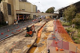
Roe Street is a street in Perth, Western Australia. The central section of the street forms the southern boundary of the suburb of Northbridge, while the eastern end borders the Perth Cultural Centre to the north and Perth railway station to the south. The southern approach of the Hamilton Interchange, which connects the Mitchell Freeway and the Graham Farmer Freeway, passes over the street to the west.
Immediately south of Roe Street was the former site of the railway marshalling yards that were originally to the west of Perth station; in the 2010s the Perth City Link project sunk and covered the remaining parts of the railway south of Northbridge and opened up the area for redevelopment.
- ^ "Roe Street". Google Maps. Retrieved 29 October 2022.
© MMXXIII Rich X Search. We shall prevail. All rights reserved. Rich X Search
