Back Roosevelt Roads German Militŝipbazo Roosevelt Roads Esperanto پایگاه دریایی روزولت رودز Persian Roosevelt Roads Naval Station French Lapangan Terbang Roosevelt Roads NS Malay Пойгоҳи дарё рӯзвилт рудз Tajik
This article needs additional citations for verification. (June 2019) |
| Roosevelt Roads Naval Station | |||||||||
|---|---|---|---|---|---|---|---|---|---|
| Ceiba in Puerto Rico, United States | |||||||||
 Roosevelt Roads Naval Station from the air, 1997 | |||||||||
 | |||||||||
| Coordinates | 18°14′17″N 65°37′40″W / 18.23806°N 65.62778°W | ||||||||
| Site information | |||||||||
| Owner | United States Navy | ||||||||
| Site history | |||||||||
| Built | 1943 | ||||||||
| In use | 1943–2004 | ||||||||
| Airfield information | |||||||||
| Identifiers | IATA: NRR[1], ICAO: TJNR, FAA LID: NRR | ||||||||
| Elevation | 38 feet (12 m) AMSL | ||||||||
| |||||||||
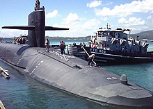
Roosevelt Roads Naval Station, nicknamed Rosy Roads,[2][3] is a former United States Navy base in the town of Ceiba, Puerto Rico. The site operates today as José Aponte de la Torre Airport, a public use airport.

- ^ "Airline and Airport Code Search". IATA. Retrieved 21 June 2019. Search Location Code for NRR
- ^ "Puerto Rico braces for the base closing". The Washington Times. 1 April 2004. Retrieved 29 June 2023.
- ^ Hiaasen, Carl (27 October 1983). "Tension builds at 'Rosy Roads'". San Francisco Examiner. p. 5 – via Newspapers.com.
© MMXXIII Rich X Search. We shall prevail. All rights reserved. Rich X Search
