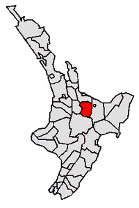
Rotorua Lakes District | |
|---|---|
 | |
 Rotorua Lakes, split by a regional boundary | |
| Coordinates: 38°13′48″S 176°16′41″E / 38.23°S 176.278°E | |
| Country | New Zealand |
| Regions |
|
| Wards | None |
| Main towns and settlements | Rotorua, Ngongotahā |
| Government | |
| • Mayor | Tania Tapsell |
| • Parliamentary electorate | Rotorua |
| • Territorial authority | Rotorua Lakes Council |
| Area | |
| • Land | 2,409.30 km2 (930.24 sq mi) |
| Population (June 2023)[2] | |
| • Total | 78,200 |
| Time zone | UTC+12 (NZST) |
| • Summer (DST) | UTC+13 (NZDT) |
| Postcode(s) | |
| Area code | 07 |
| Website | www |
Rotorua Lakes District or Rotorua District is a territorial authority district in the North Island of New Zealand. It has one urban area of significant size, the city of Rotorua. The district is governed by Rotorua Lakes Council, which is headquartered in Rotorua and is headed by a mayor. The district falls within two regional council areas, with the majority of the area and Rotorua city in the Bay of Plenty Region and the rest in the Waikato region.[3] Tania Tapsell has been the mayor of Rotorua since the 2022 local elections.
- ^ Cite error: The named reference
Areawas invoked but never defined (see the help page). - ^ "Subnational population estimates (RC, SA2), by age and sex, at 30 June 1996-2023 (2023 boundaries)". Statistics New Zealand. Retrieved 25 October 2023. (regional councils); "Subnational population estimates (TA, SA2), by age and sex, at 30 June 1996-2023 (2023 boundaries)". Statistics New Zealand. Retrieved 25 October 2023. (territorial authorities); "Subnational population estimates (urban rural), by age and sex, at 30 June 1996-2023 (2023 boundaries)". Statistics New Zealand. Retrieved 25 October 2023. (urban areas)
- ^ "About the Rotorua District". Rotorua Lakes Council. 3 July 2019. Retrieved 20 May 2020.
© MMXXIII Rich X Search. We shall prevail. All rights reserved. Rich X Search
