This article needs additional citations for verification. (May 2022) |

| ||
|---|---|---|
|
Personal Cuban Revolution |
||
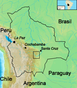
The Route of Che (la ruta del Che) is the term used to refer to the route followed by the Argentinian revolutionary Che Guevara and his men in the region of Ñancahuazú, Bolivia in 1966 and 1967.[1][2][3] This ended with his execution at La Higuera on 9 October 1967, followed by exposure of his body and burial in an unmarked grave in Vallegrande.

- ^ "Che Guevara legacy lives on in Bolivia". 26 August 2004.
- ^ "La Ruta del Che, Bolivia". The Times of India.
- ^ "On the trail of Che Guevara, 50 years on". September 2017.
© MMXXIII Rich X Search. We shall prevail. All rights reserved. Rich X Search


