Back مقاطعة روان (كنتاكي) Arabic Rowan County, Kentucky BAR Роуън (окръг, Кентъки) Bulgarian রোৱান কাউন্টি, কেন্টাকি BPY Rowan Gông (Kentucky) CDO Роуэн (гуо, Кентукки) CE Rowan County (kondado sa Tinipong Bansa, Kentucky) CEB Rowan County (Kentucky) Czech Rowan County, Kentucky Welsh Rowan County (Kentucky) German
Rowan County | |
|---|---|
 Rowan County Arts Center (formerly Rowan County Courthouse) in Morehead | |
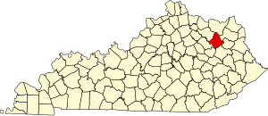
 Location within the U.S. state of Kentucky | |
 Kentucky's location within the U.S. | |
| Coordinates: 38°11′N 83°25′W / 38.19°N 83.42°W | |
| Country | |
| State | |
| Founded | 1856 |
| Named for | John Rowan |
| Seat | Morehead |
| Largest city | Morehead |
| Area | |
| • Total | 286 sq mi (740 km2) |
| • Land | 280 sq mi (700 km2) |
| • Water | 6.5 sq mi (17 km2) 2.3% |
| Population (2020) | |
| • Total | 24,662 |
| • Estimate (2023) | 24,409 |
| • Density | 86/sq mi (33/km2) |
| Time zone | UTC−5 (Eastern) |
| • Summer (DST) | UTC−4 (EDT) |
| Congressional district | 5th |
| Website | www.moreheadrowan.org /rowancounty |
Rowan County (/raʊn/, /ˈroʊ.ɪn/) is a county located in the northeastern part of the U.S. state of Kentucky, in the Eastern Kentucky Coalfield region. As of the 2020 census, the population was 24,662.[1] Its county seat is Morehead.[2]
The county was created in 1856 from parts of Fleming and Morgan counties, and named after John Rowan, who represented Kentucky in the House of Representatives and the Senate.[3]
With regard to the sale of alcohol, it is classified as a moist county in which alcohol sales are prohibited, but unlike a dry county, it contains a "wet" city, Morehead, where packaged alcohol sales are allowed.[4]
- ^ "State & County QuickFacts". United States Census Bureau. Retrieved August 28, 2022.
- ^ "Find a County". National Association of Counties. Retrieved June 7, 2011.
- ^ The Register of the Kentucky State Historical Society, Volume 1. Kentucky State Historical Society. 1903. pp. 36.
- ^ "Wet & Dry Counties in Kentucky" (PDF). Kentucky Office of Alcoholic Beverage Control. Archived from the original (PDF) on March 15, 2007. Retrieved March 21, 2007.
© MMXXIII Rich X Search. We shall prevail. All rights reserved. Rich X Search