Back Saint-Alban (munisipyo) CEB Saint-Alban (Quebec) Basque سن-آلبان، کبک Persian Saint-Alban (Québec) French Saint-Alban, Québec Swedish سینٹ-البن، کیوبک Urdu
Saint-Alban (Municipality) | |
|---|---|
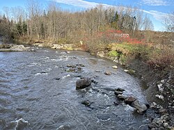
 Blanche River, Chute à Bélanger, rang de la Rivière Blanche | |
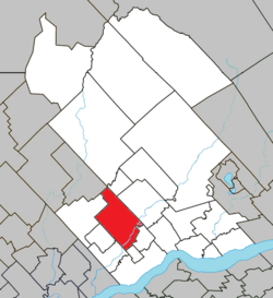
 Location within Portneuf RCM | |
| Coordinates: 46°43′00″N 72°05′00″W / 46.716667°N 72.083333°W[1][2] | |
| Country | |
| Province | |
| Region | Capitale-Nationale |
| RCM | Portneuf |
| Settled | 1830 |
| Constituted | December 31, 1991 |
| Government | |
| • Mayor | Lynn Audet |
| • Federal riding | Portneuf—Jacques-Cartier |
| • Prov. riding | Portneuf |
| Area | |
| • Total | 159.10 km2 (61.43 sq mi) |
| • Land | 149.53 km2 (57.73 sq mi) |
| Population (2011)[4] | |
| • Total | 1,225 |
| • Density | 8.2/km2 (21/sq mi) |
| • Pop 2006-2011 | |
| • Dwellings | 764 |
| Time zone | UTC−05:00 (EST) |
| • Summer (DST) | UTC−04:00 (EDT) |
| Postal code(s) | |
| Area codes | 367, 418, 581 |
| Highways | |
| Website | st-alban |
Saint-Alban is a municipality in the Capitale-Nationale region of Quebec, Canada, known for its caves, crevices and rock-climbing walls at the gorge of the Sainte-Anne River.
- ^ Cite error: The named reference
toponymiewas invoked but never defined (see the help page). - ^ Natural Resources Canada (24 April 1992). "Canadian Geographical Names Data Base: Saint-Alban (EPIMB)". www4.RNCAN.gc.ca. Retrieved 6 June 2019.
- ^ a b Ministère des Affaires municipales, des Régions et de l'Occupation du territoire - Répertoire des municipalités: Saint-Alban
- ^ a b Statistics Canada 2011 Census - Saint-Alban census profile
© MMXXIII Rich X Search. We shall prevail. All rights reserved. Rich X Search
