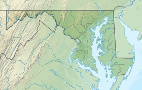
| Sandy Point State Park | |
|---|---|
 Sandy Point from the Bay Bridge | |
| Location | Anne Arundel County, Maryland, United States |
| Nearest city | Annapolis, Maryland |
| Coordinates | 39°00′59″N 76°24′06″W / 39.01639°N 76.40167°W[1] |
| Area | 786 acres (318 ha)[2] |
| Elevation | 13 ft (4.0 m)[1] |
| Designation | Maryland state park |
| Established | 1948[3] |
| Administrator | Maryland Department of Natural Resources |
| Website | Sandy Point State Park |
Sandy Point State Park is a public recreation area on Chesapeake Bay, located at the western end of the Chesapeake Bay Bridge in Anne Arundel County, Maryland.[4] The state park is known for the popularity of its swimming beach, with annual attendance exceeding one million visitors.[5] The park grounds include the Sandy Point Farmhouse, which is listed on the National Register of Historic Places.[6] The historic Sandy Point Shoal Lighthouse stands in about five feet of water some 1,000 yards (910 m) east of the park's beach.[7]
- ^ a b "Sandy Point State Park". Geographic Names Information System. United States Geological Survey, United States Department of the Interior.
- ^ Cite error: The named reference
acreagereportwas invoked but never defined (see the help page). - ^ Cite error: The named reference
mdnr3was invoked but never defined (see the help page). - ^ Cite error: The named reference
mdnrwas invoked but never defined (see the help page). - ^ Cite error: The named reference
mdnr2was invoked but never defined (see the help page). - ^ Cite error: The named reference
mdnr4was invoked but never defined (see the help page). - ^ Cite error: The named reference
mdnr5was invoked but never defined (see the help page).
© MMXXIII Rich X Search. We shall prevail. All rights reserved. Rich X Search

