Back Selenografie Afrikaans جغرافيا القمر Arabic Selenografia Catalan Selenografie Czech Selenografi Danish Selenographie German Selenografía Spanish Selenograafia Estonian ماهنگاری Persian Selenografia Finnish

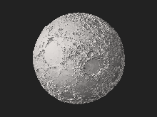
Selenography is the study of the surface and physical features of the Moon (also known as geography of the Moon, or selenodesy).[1] Like geography and areography, selenography is a subdiscipline within the field of planetary science. Historically, the principal concern of selenographists was the mapping and naming of the lunar terrane identifying maria, craters, mountain ranges, and other various features. This task was largely finished when high resolution images of the near and far sides of the Moon were obtained by orbiting spacecraft during the early space era. Nevertheless, some regions of the Moon remain poorly imaged (especially near the poles) and the exact locations of many features (like crater depths) are uncertain by several kilometers. Today, selenography is considered to be a subdiscipline of selenology, which itself is most often referred to as simply "lunar science." The word selenography is derived from the Greek word Σελήνη (Selene, meaning Moon) and γράφω graphō, meaning to write.
- ^ Dictionary of Military and Associated Terms (2005). "selenodesy" (Selenodesy is "that branch of applied mathematics that determines, by observation and measurement, the exact positions of points and the figures and areas of large portions of the moon's surface, or the shape and size of the moon".). US Department of Defense and The free dictionary (online). Retrieved 2010-06-20.
© MMXXIII Rich X Search. We shall prevail. All rights reserved. Rich X Search