Back Sembabule District CEB Distrikt Sembabule German Distrito de Sembabule Spanish Sembabule (district) French Distrito Sembabule Galician Distrik Sembabule ID Distretto di Sembabule Italian センバブレ県 Japanese 셈바불레구 Korean Sembabule (disitulikit) LG
Sembabule District | |
|---|---|
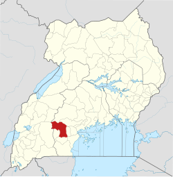
 District location in Uganda | |
| Coordinates: 00°06′S 31°30′E / 0.100°S 31.500°E | |
| Country | |
| Region | Buganda |
| Capital | Sembabule |
| Area | |
| • Total | 2,470.5 km2 (953.9 sq mi) |
| • Land | 2,318.4 km2 (895.1 sq mi) |
| • Water | 152.1 km2 (58.7 sq mi) |
| Elevation | 1,200 m (3,900 ft) |
| Population (2012 Estimate) | |
| • Total | 219,600 |
| • Density | 94.7/km2 (245/sq mi) |
| Time zone | UTC+3 (EAT) |
| Website | www |
Sembabule District is a district in the Central Region of Uganda. The town of Sembabule is the site of the district headquarters. Other urban centers in the district include Lwemiyaga and Ntuusi.[1]
- ^ Google (3 August 2016). "Map of Sembabule District, Central Region, Uganda" (Map). Google Maps. Google. Retrieved 3 August 2016.
© MMXXIII Rich X Search. We shall prevail. All rights reserved. Rich X Search