Sheikh Badr
شيخ بدر | |
|---|---|
Village | |
 Sheikh Badr house, 2008 | |
| Etymology: from personal name[1] | |
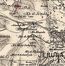
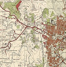
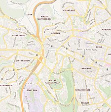
A series of historical maps of the area around Sheikh Badr (click the buttons) | |
Location within Mandatory Palestine | |
| Coordinates: 31°47′10″N 35°12′13″E / 31.78611°N 35.20361°E | |
| Geopolitical entity | Mandatory Palestine |
| Subdistrict | Jerusalem |
| Date of depopulation | January 14–19, 1948 |
Sheikh Badr (Arabic: تلة الشيخ بدر, romanized: Talla aš-Šayḫ Badr, lit. 'Hill of Sheikh Badr' Arabic pronunciation: [tɑl.let ɑʃ.ʃeːx badᵉr] ;[2] Hebrew: שייח' באדר) was a Palestinian Arab village on a hilltop in west Jerusalem. The Haganah expelled its population during the 1947–1948 Civil War in Mandatory Palestine.[3] From 1948 to 1951, Sheikh Badr Cemetery, a temporary Jewish cemetery was established here; a few hundred graves still remain from that time. After 1949, the area was incorporated into a new area called Givat Ram.
- ^ Palmer, 1881, p. 318
- ^ Yohanan., Elihai (2004). The olive tree dictionary : a transliterated dictionary of conversational Eastern Arabic (Palestinian). Minerva Instruction & Consultation. pp. 69, 522, 549. ISBN 0-9759726-0-X. OCLC 856647175.
- ^ Morris, 2004, p. 121
© MMXXIII Rich X Search. We shall prevail. All rights reserved. Rich X Search


