Back Sierra los Cuchumatanes CEB Sierra de los Cuchumatanes German Sierra de los Cuchumatanes Spanish Sierra de los Cuchumatanes French Sierra de los Cuchumatanes ID クチュマタネス山脈 Japanese Kučumataneso kalnagūbris Lithuanian Sierra de los Cuchumatanes Dutch Sierra de los Cuchumatanes NB Sierra de los Cuchumatanes Polish
| Sierra de los Cuchumatanes | |
|---|---|
 | |
| Highest point | |
| Peak | La Torre, Todos Santos Cuchumatán |
| Elevation | 3,837 m (12,589 ft) |
| Coordinates | 15°31′10″N 91°32′41″W / 15.51944°N 91.54472°W |
| Dimensions | |
| Area | 16,350 km2 (6,310 sq mi) |
| Geography | |
| Country | Guatemala |
| Regions | Huehuetenango and El Quiché |
| Geology | |
| Age of rock | Paleozoic to Mesozoic |
| Type of rock | Karst and sedimentary rock |
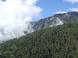
The Sierra de los Cuchumatanes is the highest non-volcanic mountain range in Central America. Its elevations range from 500 m (1,600 ft) to over 3,800 m (12,500 ft), and it covers a total area of c. 16,350 km2 (6,310 sq mi).[1] With an area of 1,500 km2 (580 sq mi) situated above 3,000 m (9,800 ft), it is also the most extensive highland region in Central America.[2][3] The Sierra de los Cuchumatanes is located in western Guatemala in the departments of Huehuetenango and El Quiché. Its western and south-western borders are marked by the Seleguá River, which separates it from the Sierra Madre volcanic chain. Its southern border is defined by the Río Negro, which flows into the Chixoy River, which turns northwards and separates the Cuchumatanes from the mountains in the Alta Verapaz region. The highest peaks, which reach up to 3,837 m (12,589 ft),[4] are located in the department of Huehuetenango.
- ^ Lovell 2005:11
- ^ "Ecosystem Profile: Northern Region, Mesoamerica - Cuchumatanes key biodiversity area". Critical Ecosystem Partnership Fund. Archived from the original on 2010-03-23. Retrieved 2009-06-16.
- ^ Marshall 2007:1-31
- ^ "31 Mountains with Prominence of 1,500 meters or greater". Central America and Caribbean Ultra-Prominence Page. Peaklist. Retrieved 2012-10-28.
© MMXXIII Rich X Search. We shall prevail. All rights reserved. Rich X Search
