Back سیمزبوری، کانتیکت AZB Симсбери (Коннектикут) CE Simsbury CEB Simsbury, Connecticut Welsh Simsbury Spanish Simsbury (Connecticut) Basque Simsbury French Simsbury, Connecticut HT Simsbury Italian Симсбюри (Коннектикут) Kazakh
Simsbury | |
|---|---|
| Town of Simsbury | |
 The Farmington Canal Heritage Trail in Simsbury | |
| Coordinates: 41°52′14″N 72°49′31″W / 41.87056°N 72.82528°W | |
| Country | |
| U.S. state | Connecticut |
| County | Hartford |
| Region | Capitol Region |
| Settled | 1642 |
| Named | 1670 |
| Government | |
| • Type | Town Manager/Board of Selectmen |
| • Town Manager | Maria Capriola |
| • Selectmen | Wendy G. Mackstutis (D), First Selectman Amber Abbuhl (D), Deputy First Selectman Sean P. Askham (R) Eric Wellman (D) Heather Goetz (R) Chris Peterson (D) |
| Area | |
| • Total | 34.3 sq mi (88.8 km2) |
| • Land | 33.9 sq mi (87.9 km2) |
| • Water | 0.4 sq mi (1.0 km2) |
| Elevation | 233 ft (71 m) |
| Population (2020) | |
| • Total | 24,517 |
| • Density | 720/sq mi (280/km2) |
| Time zone | UTC−5 (Eastern) |
| • Summer (DST) | UTC−4 (Eastern) |
| ZIP Codes | 06070, 06081, 06089, 06092 |
| Area code(s) | 860/959 |
| FIPS code | 09-68940 |
| GNIS feature ID | 0213506 |
| Website | www |
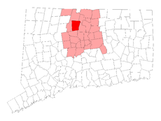
Simsbury is a town in Hartford County, Connecticut, United States, incorporated as Connecticut's 21st town in May 1670.[1] The town is part of the Capitol Planning Region. The population was 24,517 in the 2020 census.[2]
- ^ "Connecticut Towns in Order of Their Establishment". Connecticut Secretary of State. Retrieved February 7, 2023.
- ^ "Census - Geography Profile: Simsbury town, Hartford County, Connecticut". United States Census Bureau. Retrieved December 21, 2021.
© MMXXIII Rich X Search. We shall prevail. All rights reserved. Rich X Search


