| Smith River National Recreation Area | |
|---|---|
 | |
| Location | Del Norte County, California, United States |
| Nearest city | Crescent City, California |
| Coordinates | 41°55′00″N 123°52′00″W / 41.91667°N 123.86667°W |
| Area | 305,169 acres (1,235 km2) |
| Established | November 16, 1990 |
| Governing body | United States Forest Service |
| Website | Smith River National Recreation Area |
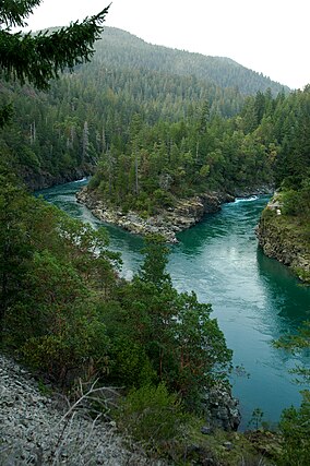
Smith River National Recreation Area is a protected area located in northwestern California, United States. The national recreation area is in Six Rivers National Forest and is managed by the U.S. Forest Service, an agency of the U.S. Department of Agriculture. Created by Congress in 1990, Smith River National Recreation Area meets the northern border of Redwood National and State Parks.
The Klamath Mountains and the Smith River, one of the longest National Wild and Scenic Rivers in the U.S., offer a variety of recreational opportunities. The National Recreation Area has five campgrounds located near major streams and along the Smith River.[1] It is considered one of the best fishing regions in the country, and rafting and canoeing are popular activities. Most hiking trails are accessible year-round, but all activities may be greatly affected by periodic heavy rainfall that swells creeks and rivers.
- ^ Roberts, Rich (April 10, 1991). "A California Time Capsule : Pristine Version of State Awaits in Smith River Recreation Area". Los Angeles Times. Retrieved 21 May 2016.
© MMXXIII Rich X Search. We shall prevail. All rights reserved. Rich X Search

