| South Branch Potomac River Tributary to Potomac River | |
|---|---|
 The South Branch near South Branch Depot, West Virginia | |
| Location | |
| Country | United States |
| State | West Virginia, Maryland, Virginia |
| Physical characteristics | |
| Source | Burners Run divide |
| • location | about 2 miles east of Hightown, Virginia |
| • coordinates | 38°25′30.43″N 079°36′30.13″W / 38.4251194°N 79.6083694°W[1] |
| • elevation | 3,520 ft (1,070 m)[1] |
| Mouth | Potomac River |
• location | about 1 mile east of Green Spring, West Virginia |
• coordinates | 39°31′42.33″N 078°35′15.05″W / 39.5284250°N 78.5875139°W[1] |
• elevation | 525 ft (160 m)[1] |
| Length | 113.51 mi (182.68 km)[2] |
| Basin size | 1,438.61 square miles (3,726.0 km2)[3] |
| Discharge | |
| • location | Potomac River |
| • average | 1,535.65 cu ft/s (43.485 m3/s) at mouth with Potomac River[3] |
| Basin features | |
| Progression | Potomac River → Chesapeake Bay → Atlantic Ocean |
| River system | Potomac River |
| Tributaries | |
| • left | Frank Run, Key Run, Elk Run, East Dry Run, Hammer Run, Moyer Run, Smith Creek, Peters Run, Buffalo Run, Kentuck Run, Reeds Creek, Briggs Run, Dry Hollow, Redman Run, North Fork South Branch Potomac River, Hoglan Run, Lunice Creek, Hutton Run, Anderson Run |
| • right | West Strait Creek, Big Run, Liberty Run, Thorn Creek, Propst Run, Conrad Gap Run, Hayes Gap Run, Deer Run, Mill Run, Landes Hollow, Mill Creek, Durgon Creek, South Fork South Branch Potomac River, Fort Run, Stony Run, Sawmill Run, Buffalo Run |
| Bridges | VA 640 (x2), Lonesome Trail, VA 25, Dickerson Mountain Road, Gambill Road, US 33, Hammer Homestead Drive, Potomac River Lane, Squire Lane, Schmucker Road, US 220, South Branch Trail, US 220 (x2), Fisher Road, US 48, US 220, US 50, WV 28, Springfield Pike |

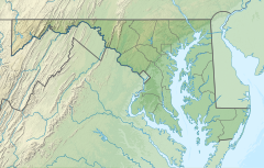
The South Branch Potomac River has its headwaters in northwestern Highland County, Virginia, near Hightown along the eastern edge of the Allegheny Front. After a river distance of 139 miles (224 km),[4] the mouth lies east of Green Spring, Hampshire County, West Virginia, where it meets the North Branch Potomac River to form the Potomac.[5]
- ^ a b c d "Geographic Names Information System". edits.nationalmap.gov. US Geological Survey. Retrieved 7 November 2022.
- ^ "ArcGIS Web Application". epa.maps.arcgis.com. US EPA. Retrieved November 5, 2022.
- ^ a b "South Branch Potomac River Watershed Report". watersgeo.epa.gov. US EPA. Retrieved 7 November 2022.
- ^ U.S. Geological Survey. National Hydrography Dataset high-resolution flowline data. The National Map Archived March 29, 2012, at the Wayback Machine. Retrieved August 15, 2011
- ^ Topographic map of the confluence of the North and South branches of the Potomac River Archived March 12, 2007, at the Wayback Machine
© MMXXIII Rich X Search. We shall prevail. All rights reserved. Rich X Search

