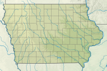
Back مطار جنوب شرق ولايه آيوا الاقليمى ARZ Burlington Municipal Airport (tugpahanan sa Tinipong Bansa, Iowa) CEB Southeast Iowa Regional Airport German فرودگاه محلی سوت ایست آیوا Persian Aeroportul Regional Southeast Iowa Romanian Фурудгоҳи маҳал сӯят оист оюо Tajik ساوتھ ایسٹ آئیووا ریجنل ہوائی اڈا Urdu
Southeast Iowa Regional Airport | |||||||||||||||
|---|---|---|---|---|---|---|---|---|---|---|---|---|---|---|---|
 | |||||||||||||||
| Summary | |||||||||||||||
| Airport type | Public | ||||||||||||||
| Owner | Southeast Iowa Regional Airport Authority | ||||||||||||||
| Serves | Burlington, Iowa | ||||||||||||||
| Elevation AMSL | 698 ft / 213 m | ||||||||||||||
| Coordinates | 40°46′59″N 091°07′32″W / 40.78306°N 91.12556°W | ||||||||||||||
| Website | flybrl.com | ||||||||||||||
| Maps | |||||||||||||||
 FAA airport diagram | |||||||||||||||
| Runways | |||||||||||||||
| |||||||||||||||
| Statistics | |||||||||||||||
| |||||||||||||||
Southeast Iowa Regional Airport (IATA: BRL, ICAO: KBRL, FAA LID: BRL) is a public airport located two miles southwest of Burlington, in Des Moines County, Iowa.[1] It is owned by the Southeast Iowa Regional Airport Authority[1] which includes representatives from the city of Burlington, the city of West Burlington, and Des Moines County. The airport is used for general aviation and sees one airline, a service subsidized by the federal government's Essential Air Service program at a cost of $1,917,566 (per year).[2]
The National Plan of Integrated Airport Systems for 2021–2025 categorized it as a non-primary commercial service airport (between 2,500 and 10,000 enplanements per year).[3]
- ^ a b c FAA Airport Form 5010 for BRL PDF. Federal Aviation Administration. effective December 30, 2021.
- ^ "Essential Air Service Reports". U.S. Department of Transportation. Retrieved June 7, 2014.
- ^ "2011–2015 NPIAS Report, Appendix A" (PDF, 2.03 MB). National Plan of Integrated Airport Systems. Federal Aviation Administration. October 4, 2010.
© MMXXIII Rich X Search. We shall prevail. All rights reserved. Rich X Search

