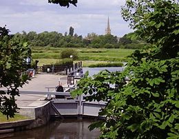
| St John's Lock | |
|---|---|
 St John's Lock, with Lechlade in the background | |
 | |
| Waterway | River Thames |
| County | Gloucestershire |
| Maintained by | Environment Agency |
| Operation | Manual |
| First built | 1790 |
| Latest built | 1905 |
| Length | 33.60 m (110 ft 3 in) [1] |
| Width | 4.52 m (14 ft 10 in)[1] |
| Fall | 0.85 m (2 ft 9 in)[1] |
| Above sea level | 233 ft (71 m) |
| Distance to Teddington Lock | 123 miles |
St John's Lock | ||||||||||||||||||||||||||||||||||||||||||||||||||||||||||||||||||||||||||||||||||||||||||||||||||||||||||||||||
|---|---|---|---|---|---|---|---|---|---|---|---|---|---|---|---|---|---|---|---|---|---|---|---|---|---|---|---|---|---|---|---|---|---|---|---|---|---|---|---|---|---|---|---|---|---|---|---|---|---|---|---|---|---|---|---|---|---|---|---|---|---|---|---|---|---|---|---|---|---|---|---|---|---|---|---|---|---|---|---|---|---|---|---|---|---|---|---|---|---|---|---|---|---|---|---|---|---|---|---|---|---|---|---|---|---|---|---|---|---|---|---|---|
| ||||||||||||||||||||||||||||||||||||||||||||||||||||||||||||||||||||||||||||||||||||||||||||||||||||||||||||||||
St John's Lock, below the town of Lechlade, Gloucestershire, is the furthest upstream lock on the River Thames in England. The name of the lock derives from a priory that was established nearby in 1250, but which no longer exists. The lock was built of stone in 1790 by the Thames Navigation Commission.
The main weir is downstream, just below St John's Bridge, where the River Cole and the River Leach join the Thames on opposite banks.
A statue of Old Father Thames by Raffaelle Monti is outside the lock house. The statue was commissioned in 1854 for The Crystal Palace's grounds, was later moved to the traditional source of the Thames at Thames Head, and then in 1974 relocated to St John's Lock.[2] The statue is Grade II listed.[3]
- ^ a b c "Environment Agency Dimensions of locks on the River Thames". web page. Environmental Agency. 8 November 2012. Retrieved 17 November 2012. Dimensions given in metres.
- ^ Sharp, David (2001) The Thames Path, National trail guides 16, London : Aurum, ISBN 1-85410-773-9, p.46
- ^ Historic England. "Thames Head Statue, St John's Lock (1182045)". National Heritage List for England. Retrieved 20 June 2021.
© MMXXIII Rich X Search. We shall prevail. All rights reserved. Rich X Search
