Back Propinsi Surigao del Sur ACE سوريجاو ديل سور Arabic گونئی سوریقائو AZB Surigao del Sur BCL Surigao del Sur CBK-ZAM Surigao del Sur CEB Surigao del Sur German Surigao del Sur Spanish سوریگائو جنوبی Persian Surigao del Sur Finnish
Surigao del Sur | |
|---|---|
| Province of Surigao del Sur | |
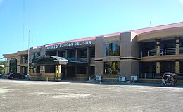
(from top: left to right) Tinuy-an Falls in Bislig, White beach in Cagwait, surfer in beach of Lanuza, Hinatuan River, Britania Islands and Surigao del Sur Provincial Capitol. | |
| Nickname: Shangri-La by the Pacific[1] | |
 Location in the Philippines | |
| Coordinates: 8°40′N 126°00′E / 8.67°N 126°E | |
| Country | Philippines |
| Region | Caraga |
| Founded | June 19, 1960 |
| Capital | Tandag |
| Largest city | Bislig |
| Government | |
| • Type | Sangguniang Panlalawigan |
| • Governor | Alexander T. Pimentel (PDP–Laban) |
| • Vice Governor | Manuel O. Alameda (Hugpong Surigao Sur) |
| • Legislature | Surigao del Sur Provincial Board |
| Area | |
| • Total | 4,932.70 km2 (1,904.53 sq mi) |
| • Rank | 21st out of 81 |
| Highest elevation | 611 m (2,005 ft) |
| Population (2020 census)[3] | |
| • Total | 642,255 |
| • Rank | 47th out of 81 |
| • Density | 130/km2 (340/sq mi) |
| • Rank | 66th out of 81 |
| Divisions | |
| • Independent cities | 0 |
| • Component cities | |
| • Municipalities | |
| • Barangays | 309 |
| • Districts | Legislative districts of Surigao del Sur |
| Time zone | UTC+8 (PHT) |
| ZIP code | 8300–8318 |
| IDD : area code | +63 (0)86 |
| ISO 3166 code | PH-SUR |
| Spoken languages | |
| Income classification | 1st class |
| Website | www |
Surigao del Sur (Surigaonon: Probinsya nan Surigao del Sur; Cebuano: Habagatang Surigao; Tagalog: Timog Surigao), officially the Province of Surigao del Sur, is a province in the Philippines located in the Caraga region in Mindanao. Its capital is Tandag City. Surigao del Sur is situated at the eastern coast of Mindanao and faces the Philippine Sea to the east.
- ^ Caraganon.com
- ^ "List of Provinces". PSGC Interactive. Makati, Philippines: National Statistical Coordination Board. Retrieved April 1, 2014.
- ^ Census of Population (2020). Table B - Population and Annual Growth Rates by Province, City, and Municipality - By Region. Philippine Statistics Authority. Retrieved July 8, 2021.
© MMXXIII Rich X Search. We shall prevail. All rights reserved. Rich X Search


