Back تاكورا (جبل بركانى) ARZ Volcán Tacora CEB Tacora Czech Tacora German Volcán Tacora Spanish تاکورا Persian Tacora French Monte Tacora Italian ტაკორა Georgian Tacora LLD
| Tacora | |
|---|---|
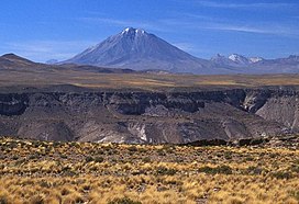
 Tacora in 2004 | |
| Highest point | |
| Elevation | 5,980 m (19,620 ft)[1] |
| Prominence | 1,721 m (5,646 ft)[2] |
| Parent peak | Nevado Sajama |
| Listing | Ultra |
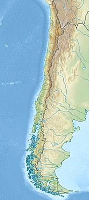
| Coordinates | 17°43′14″S 69°46′22″W / 17.72056°S 69.77278°W |
| Geography | |
| Parent range | Andes |
| Geology | |
| Mountain type | Stratovolcano |
| Volcanic arc/belt | Central Volcanic Zone |
| Last eruption | Unknown |
Tacora is a stratovolcano located in the Andes of the Arica y Parinacota Region of Chile. Near the border with Peru, it is one of the northernmost volcanoes of Chile. It is part of the Central Volcanic Zone in Chile, one of the four volcanic belts of the Andes. The Central Volcanic Zone has several of the highest volcanoes in the world. Tacora itself is a stratovolcano with a caldera and a crater. The youngest radiometric age is 50,000 years ago and it is heavily eroded by glacial activity.
Volcanism in the Central Volcanic Zone results from the subduction of the Nazca Plate beneath the South America Plate. Tacora is constructed on the so-called "Arica Altiplano" and is part of a north–south alignment of volcanoes. Tacora itself has uncertain reports of historical eruptions and there are active fumaroles.
The fumarolic activity has resulted in the emplacement of substantial deposits of sulfur, which were already mentioned centuries ago. Towards the latter 19th century, systematic mining of the sulfur deposits of Tacora occurred and substantial mining infrastructure was constructed on the mountain.
© MMXXIII Rich X Search. We shall prevail. All rights reserved. Rich X Search
