Back Tanjung Pinang ACE تانجونغ (بينانغ) Arabic Kota Tanjungpinang BAN Танджунг-Пінанг Byelorussian Kota Tanjungpinang BEW Tanjung Pinang Catalan Tanjungpinang CEB Tanjung Pinang Danish Tanjung Pinang German Tanjung Pinang Esperanto
Tanjungpinang | |
|---|---|
| City of Tanjungpinang Kota Tanjungpinang | |
| Regional transcription(s) | |
| • Jawi | تنجوڠ ڤينڠ |
| • Chinese | 丹戎檳榔/廖都 |
|
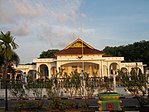
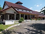
From top, left to right: City view from Dompak Island, house of governor of the Riau Islands, tombs of Riau kings, Raja Haji Fisabilillah Monument, and Sultan Sulaiman Badrul Alamsyah Museum | |
| Nickname: Kota Gurindam (lit. 'City of Gurindam') | |
| Motto(s): Jujur Bertutur, Bijak Bertindak (lit. 'Honest in Speak, Wise in Action') | |
 Location within Riau Islands | |
| Coordinates: 0°55′08″N 104°27′19″E / 0.918773°N 104.455415°E | |
| Country | |
| Region | Sumatra |
| Province | |
| Settled | Early 3rd century |
| Founded | 6 January 1784[1] |
| Incorporated | 21 June 2001[2] |
| Government | |
| • Acting Mayor | Hasan |
| Area | |
| • Total | 812.7 km2 (313.8 sq mi) |
| • Land | 144.56 km2 (55.81 sq mi) |
| Elevation | 18 m (59 ft) |
| Population (mid 2022 estimate[3]) | |
| • Total | 239,854 |
| • Density | 300/km2 (760/sq mi) |
| Time zone | UTC+7 (Indonesia Western Time) |
| Area code | (+62) 771 |
| Website | tanjungpinangkota |
Tanjungpinang, also colloquially written as Tanjung Pinang, is the capital city of the Indonesian province of Riau Islands. It covers a land area of 144.56 km2, mainly on the southern Bintan Island, as well as other smaller islands such as Dompak Island and Penyengat Island.[4] With a population of 227,663 at the 2020 Census,[5] it is the second largest city of the province, after Batam;[6] the official estimate as at mid 2022 was 239,854 (comprising 120,833 males and 119,021 females).[3] Tanjungpinang is a historic city of the Malay culture, having served as the capital of both Johor Sultanate and Riau-Lingga Sultanate.
Tanjungpinang – whose name is taken from the position of a beach tree that juts into the sea – occupies a strategic location on the south of Bintan Island, guarding the mouth of the Bintan River. Tanjungpinang has ferry and speedboat connections to Batam, Singapore (40 km away), and Johor Bahru. The city is also served by Raja Haji Fisabilillah International Airport, located about 7 km east of the city center.
Over the centuries, Tanjungpinang came under the control of Sumatra, Malacca, the Netherlands, Britain, and Japan. These contacts each influenced its culture, also being a centre of Malay culture and trade traffic. In the 18th century, it was a capital of the Johor–Riau–Lingga Empire.
- ^ Sani, Muhammad (8 February 2013). Untung Sabut Muhammad Sani (in Indonesian). Gramedia Pustaka Utama. ISBN 978-602-03-5358-6.
- ^ RI, Setjen DPR. "J.D.I.H. - Dewan Perwakilan Rakyat". www.dpr.go.id (in Indonesian). Retrieved 3 June 2020.
- ^ a b Badan Pusat Statistik, Jakarta, 2023, Kota Tanjungpinang Dalam Angka 2023 (Katalog-BPS 1102001.2172)
- ^ "Kabupaten - Kementerian Dalam Negeri - Republik Indonesia". 31 October 2013. Archived from the original on 31 October 2013. Retrieved 3 June 2020.
- ^ Badan Pusat Statistik, Jakarta, 2021.
- ^ "Badan Pusat Statistik Provinsi Kepulauan Riau". kepri.bps.go.id. Retrieved 3 June 2020.
© MMXXIII Rich X Search. We shall prevail. All rights reserved. Rich X Search


