Back تاواو Arabic تاواو ARZ Тавау Bulgarian ᨈᨓᨓᨘ BUG Tawau (lungsod) CEB Tawau German Tawau Esperanto Tawau Spanish تاوو Persian Tawau French
Tawau
Tawao | |
|---|---|
Town and district capital | |
| Bandar Tawau | |
| Other transcription(s) | |
| • Jawi | تاواو |
| • Chinese | 斗湖 (Simplified) 鬥湖 (Traditional) Dǒuhú (Hanyu Pinyin) |
| • Tamil | தவாவ் Tavāv (Transliteration) |
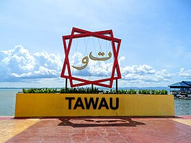
From top, left to right: City sign, Aerial view towards the town center, Aerial view towards Cowie Bay | |
| Motto: Bumi Peladang | |
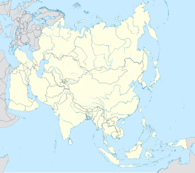
 Location of Tawau in Sabah | |
| Coordinates: 04°15′30″N 117°53′40″E / 4.25833°N 117.89444°E | |
| Country | |
| State | |
| Division | Tawau |
| District | Tawau |
| Bruneian Empire | 15th century–1658 |
| Sultanate of Sulu | 1658–1882 |
| Sultanate of Bulungan | 1750 |
| Founded | 1893 |
| Settled by North Borneo Chartered Company | 1898 |
| Municipality | 1 January 1982 |
| Government | |
| • Council President | Pang Pick Lim @ Joseph |
| Area | |
| • Town | 55.9 km2 (21.6 sq mi) |
| • Municipality | 2,240 km2 (860 sq mi) |
| Elevation | 8 m (26 ft) |
| Population (2020 Census) | |
| • Municipality | 372,615 |
| Time zone | UTC+8 (MST) |
| • Summer (DST) | Not observed |
| Postal code | 91000 |
| Area code(s) | 089 |
| Vehicle registration | ET (1967-1980), ST (1980-2018), SW (2019-Present) |
| Website | mpt |
Tawau (Malaysian: [ˈta wau]), formerly known as Tawao, is the capital of the Tawau District in Sabah, Malaysia. It is the third-largest city in Sabah, after Kota Kinabalu and Sandakan. It is located on the Semporna Peninsula in the southeast coast of the state in the administrative centre of Tawau Division, which is bordered by the Sulu Sea to the east, the Celebes Sea to the south at Cowie Bay[note 1] and shares a border with North Kalimantan, Indonesia. The town had an estimated population as of 2010[update], of 113,809,[2] while the whole municipality area had a population of 397,673 (including 47,466 in Kalabakan, subsequently split off to form a separate district).[2][note 2] The municipal area had a population of 372,615 at the 2020 Census.[3]
Before the founding of Tawau, the region around it was the subject of dispute between the British and Dutch spheres of influence. In 1893, the first British merchant vessel sailed into Tawau, marking the opening of the town's seaport. In 1898, the British set up a settlement in Tawau. The North Borneo Chartered Company (BNBC) accelerated growth of the settlement's population by encouraging the immigration of Chinese. Consequent to the Japanese occupation of North Borneo, the Allied forces bombed the town in mid-1944, razing it to the ground. After the Japanese surrender in 1945, 2,900 Japanese soldiers in Tawau became prisoners of war and were transferred to Jesselton. Tawau was rebuilt after the war, and by the end of 1947, the economy was restored to its pre-war status. Tawau was also the main point of conflict during the Indonesia–Malaysia confrontation from 1963 to 1966. During that period, it was garrisoned by the British Special Boat Section, and guarded by Australian Destroyers and combat aircraft. In December 1963, Tawau was bombed twice by Indonesia and shootings occurred across the Tawau-Sebatik Island international border. Indonesians were found trying to poison the town's water supply. In January 1965, a curfew was imposed to prevent Indonesian attackers from making contact with Indonesians living in the town. While in June 1965, another attempted invasion by the Indonesian forces was repelled by bombardment by an Australian destroyer. Military conflict finally ended in December 1966.
Among the tourist attractions in Tawau are: the Tawau International Cultural Festival, Tawau Bell Tower, Japanese War Cemetery, Confrontation Memorial, Teck Guan Cocoa Museum, Tawau Hills National Park, Bukit Gemok, and Tawau Tanjung Markets. The main economic activities of the town are: timber, cocoa, oil palm plantations, and prawn farming.
- ^ "Malaysia Elevation Map (Elevation of Tawau)". Flood Map : Water Level Elevation Map. Archived from the original on 22 August 2015. Retrieved 22 August 2015.
- ^ a b "Total population by ethnic group, Local Authority area and state, Malaysia, 2010" (PDF). Department of Statistics Malaysia. Archived from the original (PDF) on 14 November 2013. Retrieved 14 September 2013.
- ^ Dept. of Statistics Malaysia (web).
Cite error: There are <ref group=note> tags on this page, but the references will not show without a {{reflist|group=note}} template (see the help page).
© MMXXIII Rich X Search. We shall prevail. All rights reserved. Rich X Search


