Back مقاطعة تيلفير (جورجيا) Arabic Telfair County, Georgia BAR Телфеър (окръг, Джорджия) Bulgarian টেলফেয়ার কাউন্টি, জর্জিয়া BPY Telfair Gông (Georgia) CDO Телфэр (гуо, Джорджи) CE Telfair County CEB Telfair County, Georgia Welsh Telfair County German Condado de Telfair Spanish
Telfair County | |
|---|---|
 Telfair County Courthouse in McRae-Helena | |
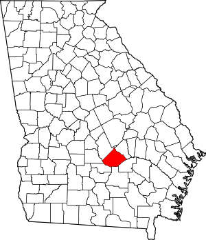
 Location within the U.S. state of Georgia | |
 Georgia's location within the U.S. | |
| Coordinates: 31°56′N 82°56′W / 31.93°N 82.94°W | |
| Country | |
| State | |
| Founded | December 10, 1807 |
| Named for | Edward Telfair |
| Seat | McRae-Helena |
| Largest city | McRae-Helena |
| Area | |
| • Total | 444 sq mi (1,150 km2) |
| • Land | 437 sq mi (1,130 km2) |
| • Water | 6.7 sq mi (17 km2) 1.5% |
| Population (2020) | |
| • Total | 12,477 |
| • Density | 29/sq mi (11/km2) |
| Time zone | UTC−5 (Eastern) |
| • Summer (DST) | UTC−4 (EDT) |
| Congressional district | 8th |
| Website | telfaircounty |
Telfair County is a county located in the central portion of the U.S. state of Georgia. As of the 2020 census, the population was 12,477.[1] The largest city and county seat is McRae-Helena.[2]
In 2009, researchers from the Fernbank Museum of Natural History announced having found artifacts they associated with the 1541 Hernando de Soto Expedition at a private site near the Ocmulgee River, the first such find between Tallahassee, Florida and western North Carolina. De Soto's expedition was well recorded, but researchers have had difficulties finding artifacts from sites where he stopped. This site was an indigenous village occupied by the historic Creek people from the early 15th century into the 16th century. It was located further southeast than de Soto's expedition was thought to go in Georgia.[3]
- ^ "Census - Geography Profile: Telfair County, Georgia". United States Census Bureau. Retrieved December 29, 2022.
- ^ "Find a County". National Association of Counties. Retrieved June 7, 2011.
- ^ Hudson, Charles M. (1997). Knights of Spain, Warriors of the Sun. University of Georgia Press. pp. 157–162.
© MMXXIII Rich X Search. We shall prevail. All rights reserved. Rich X Search