Back তিরুবল্ল Bengali/Bangla ঠিরুৱল্ল BPY Tiruvalla CEB Tiruvalla German Thiruvalla Spanish Thiruvalla Finnish Tiruvalla French טירובלה HE तिरुवल्ला Hindi Thiruvalla Italian
Thiruvalla | |
|---|---|
Municipality | |
From top to bottom: 1.KSRTC Terminal Complex is one of its four BOT depots[1][2] 2.Panoramic view of SCS Junction.
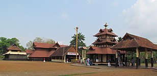
3.Sreevallabha Temple | |
| Coordinates: 9°23′08″N 76°34′32″E / 9.38556°N 76.57556°E | |
| Country | |
| State | Kerala |
| District | Pathanamthitta |
| Area | |
| • Total | 27.15 km2 (10.48 sq mi) |
| Elevation | 14 m (46 ft) |
| Population (2011)[3] | |
| • Total | 52,883 |
| • Density | 1,948/km2 (5,050/sq mi) |
| Languages | |
| • Official | Malayalam, English |
| Time zone | UTC+5:30 (IST) |
| PIN | 689101 |
| Telephone code | 91-469 |
| Vehicle registration | KL-27 |
| Website | www |
Thiruvalla, (Malayalam: [t̪iɾuʋɐlːɐ]) also spelled Tiruvalla, is a municipality in Pathanamthitta district, Kerala, India. It is also the headquarters of the Thiruvalla taluk.[4] The town is spread over an area of 27.15 km2 (10.48 sq mi) and has a population of 52,883, down from 56,837 in 2001. It lies on the northern banks of the Manimala River, in a land-locked region surrounded by irrigating canals and rivers. It is the largest town in the district, and is one of the financial, educational,healthcare, cultural, and commercial centres of central Travancore.
Thiruvalla is also known as the "Town of Non-Resident Indians", as a large portion of its inhabitants form a part of the Malayali diaspora. Though Thiruvalla struggles with an aging and declining population and experiences a high emigration rate, in recent years the town has experienced growth in its economy and urban revitalisation.[citation needed]
- ^ "BOT experiment of KSRTC faces huge loss". Mathrubhumi. Retrieved 12 April 2014.
- ^ "KSRTC's parasitism bleeding KTDFC". The Times of India. Retrieved 22 January 2021.
- ^ "Census of India: Search Details". Archived from the original on 18 May 2015.
- ^ "Subdivisions Taluks and Villages | Pathanamthitta District, Government of Kerala | India".
© MMXXIII Rich X Search. We shall prevail. All rights reserved. Rich X Search


