Back Tiller (Trondheim) German Tiller Italian Tiller (Noorwegen) Dutch Tiller NN Tiller NB Tillers kommun Swedish
Tiller Municipality
Tiller herred | |
|---|---|
| Tilder herred (historic name) | |
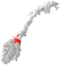
 Sør-Trøndelag within Norway | |
 Tiller within Sør-Trøndelag | |
| Coordinates: 63°20′34″N 10°25′34″E / 63.34278°N 10.42611°E | |
| Country | Norway |
| County | Sør-Trøndelag |
| District | Trondheim Region |
| Established | 1 Jan 1899 |
| • Preceded by | Klæbu Municipality |
| Disestablished | 1 Jan 1964 |
| • Succeeded by | Trondheim Municipality |
| Administrative centre | Heimdal |
| Area (upon dissolution) | |
| • Total | 24 km2 (9 sq mi) |
| Population (1964) | |
| • Total | 3,595 |
| • Density | 150/km2 (390/sq mi) |
| Demonym | Tillerbygg[1] |
| Time zone | UTC+01:00 (CET) |
| • Summer (DST) | UTC+02:00 (CEST) |
| ISO 3166 code | NO-1661[2] |
Tiller is a former municipality in the old Sør-Trøndelag county, Norway. The 24-square-kilometre (9.3 sq mi) municipality of Tiller existed from 1899 until its dissolution in 1964. The municipality encompassed part of the south-central part of what is now the municipality of Trondheim in Trøndelag county. The municipality was generally located between the river Nidelva in the east and the Dovrebanen railway line. The administrative centre was located at Heimdal, on the western edge of the municipality. The local Tiller Church was built shortly after the creation of the municipality (1901) to serve its residents.[3]
- ^ "Navn på steder og personer: Innbyggjarnamn" (in Norwegian). Språkrådet.
- ^ Bolstad, Erik; Thorsnæs, Geir, eds. (26 January 2023). "Kommunenummer". Store norske leksikon (in Norwegian). Kunnskapsforlaget.
- ^ Thorsnæs, Geir, ed. (22 December 2015). "Tiller – tidligere kommune". Store norske leksikon (in Norwegian). Kunnskapsforlaget. Retrieved 17 March 2018.
© MMXXIII Rich X Search. We shall prevail. All rights reserved. Rich X Search