| Tinder Fire | |
|---|---|
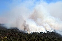
 Tinder Fire on April 30, 2018 | |
| Date(s) | April 27 – May 24, 2018 |
| Location | Coconino National Forest, Arizona, United States |
| Coordinates | 34°33′29″N 111°09′40″W / 34.558°N 111.161°W |
| Statistics | |
| Burned area | 16,309 acres (6,600 ha; 25.483 sq mi) |
| Impacts | |
| Structures destroyed | 96 |
| Damage | $7.5 million (equivalent to $9.1 million in 2023) |
| Ignition | |
| Cause | Illegal campfire |
| Map | |
The Tinder Fire was a wildfire that burned 16,309 acres (6,600 ha) of the Coconino National Forest in the U.S. state of Arizona during April and May 2018. The fire was detected by a United States Forest Service (USFS) lookout tower on April 27, 2018, and firefighters began working to contain its spread within the day. Benefiting from strong winds, low humidity, and high temperatures, the fire grew rapidly over late April, prompting the closure of Arizona State Route 87 and evacuation orders for 1,000 houses in Coconino County. These orders remained until May 4. Almost 700 firefighters were involved in combating the fire, which was fully contained on May 24. The investigation into the fire determined that the Tinder Fire was caused by a prohibited campfire.
© MMXXIII Rich X Search. We shall prevail. All rights reserved. Rich X Search


