Back ضاحية تيروبور Arabic تيروبور ARZ तिरुपुर जिला Bihari Tiruppur (distrito) CEB Tiruppur (Distrikt) German Distrito de Tirupur Spanish Tiruppur barrutia Basque بخش تیروپور Persian Tiruppurin piirikunta Finnish District de Tiruppur French
This article needs additional citations for verification. (April 2013) |
Tiruppur District | |
|---|---|
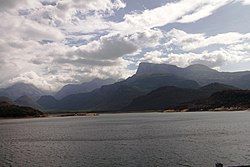
Clockwise from top-left: Sri Venkatesha Perumal Temple, Mondipalayam, Amaravathi statue in Dharapuram, Thiru Sugriswara Temple, Amaravathi Dam, Bridge over the Noyyal River in Tiruppur | |
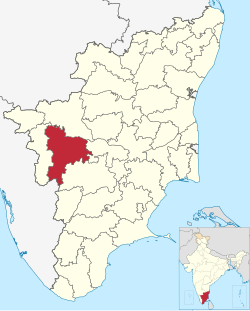
 Location in Tamil Nadu | |
| Coordinates: 11°11′N 77°15′E / 11.18°N 77.25°E | |
| Country | |
| State | |
| Headquarters | Tiruppur |
| Taluks | Avinashi, Dharapuram, Kangeyam, Madathukulam, Palladam, Tiruppur North, Tiruppur South, Udumalaipettai, Uthukuli |
| Government | |
| • District Collector | Thiru Dr.S. Vineeth I.A.S |
| Population (2011) | |
| • Total | 2,479,052 |
| Languages | |
| • Official | Tamil |
| Time zone | UTC+5:30 (IST) |
| Telephone code | +91-0421 |
| Vehicle registration | TN-39,TN-39Z,TN-42,TN-42Y,TN-78,TN-78M |
| Website | tiruppur |
Tiruppur District is one of the 38 districts of the Indian state of Tamil Nadu, formed in 22 February 2009. Dharapuram was the largest taluk by area in the district. The district is well-developed and industrialized. The Tiruppur banian industry, the cotton market, Kangeyam bull and Uthukkuli butter, among other things, provide for a vibrant economy.[1] The city of Tiruppur is the administrative headquarters for the district. As of 2011, the district had a population of 2,479,052 with a sex-ratio of 989 females for every 1,000 males.
- ^ "New Tiruppur district formed". The Hindu. 26 October 2008. Archived from the original on 29 October 2008. Retrieved 27 October 2008.
© MMXXIII Rich X Search. We shall prevail. All rights reserved. Rich X Search


