| Toutle River | |
|---|---|
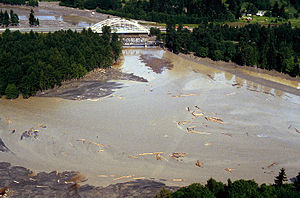
 Mouth of the river in flood near Castle Rock before the 1980 eruption of Mount St. Helens | |
Location of the mouth of Toutle River in Washington | |
| Etymology | A Native American subgroup called Hullooetell by Lewis and Clark[2] |
| Location | |
| Country | United States |
| State | Washington |
| County | Cowlitz |
| Physical characteristics | |
| Source | Confluence of North and South forks |
| • location | near Toutle |
| • coordinates | 46°19′40″N 122°43′03″W / 46.32778°N 122.71750°W |
| • elevation | 440 ft (130 m)[3] |
| Mouth | Cowlitz River |
• location | near Castle Rock |
• coordinates | 46°18′39″N 122°55′06″W / 46.31083°N 122.91833°W[1] |
• elevation | 46 ft (14 m)[1] |
| Length | 17.2 mi (27.7 km)[4] |
| Basin size | 511 sq mi (1,320 km2) |
| Discharge | |
| • location | 6.5 miles (10.5 km) from the mouth[5] |
| • average | 2,095 cu ft/s (59.3 m3/s)[5] |
| • minimum | 243 cu ft/s (6.9 m3/s) |
| • maximum | 61,800 cu ft/s (1,750 m3/s) |
The Toutle River is a 17.2-mile (27.7 km) tributary of the Cowlitz River in the U.S. state of Washington. It rises in two forks merging near Toutle below Mount St. Helens and joins the Cowlitz near Castle Rock, 20 miles (32 km) upstream of the larger river's confluence with the Columbia River.[4]
The river was altered by the 1980 eruption of Mount St. Helens, a nearby volcano, and subsequent flows of ash and other debris. It was further altered by dredging to remove sediment, and by construction of the Toutle River Sediment Retention Structure on the North Fork Toutle River.
- ^ a b "Toutle River". Geographic Names Information System. United States Geological Survey. September 10, 1979. Retrieved July 20, 2010.
- ^ Bright, William (2004). Native American Placenames of the United States. Norman, Oklahoma: University of Oklahoma Press. p. 510. ISBN 0-8061-3576-X.
- ^ Derived via Google Earth using Geographic Names Information System (GNIS) source coordinates.
- ^ a b United States Geological Survey. "United States Topographic Map". TopoQuest. Retrieved February 10, 2013. River miles are marked and numbered on the relevant map quadrangles.
- ^ a b "Water-Data Report 2011: 14242580 Toutle River at Tower Road, Near Silver Lake, WA" (PDF). United States Geological Survey. Retrieved February 11, 2013.
© MMXXIII Rich X Search. We shall prevail. All rights reserved. Rich X Search

