| Tualatin Valley | |
|---|---|
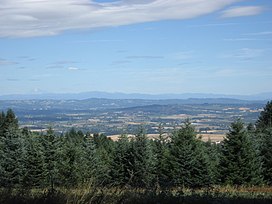
 The Tualatin Valley from Bald Peak State Scenic Viewpoint | |
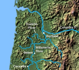
 The Tualatin River | |
| Floor elevation | 180 ft (55 m) |
| Geography | |
| Location | Washington County & Clackamas County, Oregon |
| Borders on |
|
| Coordinates | 45°30′38″N 122°59′19″W / 45.51056°N 122.98861°W |
| Coordinates[1] | |
The Tualatin Valley is a farming and suburban region southwest of Portland, Oregon. The valley is formed by the meandering Tualatin River, a tributary of the Willamette River at the northwest corner of the Willamette Valley, east of the Northern Oregon Coast Range. Most of the valley is located within Washington County, separated from Portland by the Tualatin Mountains. Communities in the Tualatin Valley include Banks, Forest Grove, Cornelius, Hillsboro, Aloha, Beaverton, Sherwood, Tigard, and Tualatin.
- ^ "Tualatin Valley". Geographic Names Information System. United States Geological Survey, United States Department of the Interior. 2006-03-03. Retrieved 2009-11-15.
© MMXXIII Rich X Search. We shall prevail. All rights reserved. Rich X Search
