Back Tulancingo de Bravo (municipi) Catalan Tulancingo de Bravo (munisipyo sa Mehiko) CEB Municipio Tulancingo de Bravo German Tulancingo de Bravo Esperanto Municipio de Tulancingo de Bravo Spanish Tulancingo de Bravo (udalerria) Basque تولانسینگو Persian Tulancingo French Tulancingo de Bravo Italian Tulancingo de Bravo LAD
Tulancingo | |
|---|---|
Municipality and city | |
 An evening view of Tulancingo, from the Cerro del Tezontle | |
| Coordinates: 20°5′0″N 98°22′0″W / 20.08333°N 98.36667°W | |
| Country | |
| State | Hidalgo |
| Municipality | Tulancingo |
| Government | |
| • Municipal President | Jorge Márquez Alvarado |
| Area | |
| • Total | 290.4 km2 (112.1 sq mi) |
| Elevation | 2,181 m (7,156 ft) |
| Population (2010) | |
| • Total | 151,582 |
| • Density | 352.64/km2 (913.3/sq mi) |
| Website | http://www.tulancingo.gob.mx |
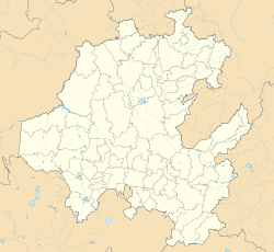
Tulancingo (officially Tulancingo de Bravo; Otomi: Ngu̱hmu) is the second-largest city in the Mexican state of Hidalgo. It is located in the southeastern part of the state and also forms one of the 84 municipalities of Hidalgo, as well as the Archdiocese of Tulancingo. Located 93 km from Mexico City, this area is the most important wool textile producer in the country and was home to El Santo, Mexico's most famous lucha libre wrestler, and to Gabriel Vargas (cartoonist), author of the popular cartoon La Familia Burrón. It is also home to the Huapalcalco archeological site, which was the forerunner to the Teotihuacan civilization. The name derives from the Nahuatl words “tule” and “tzintle” which mean “in or behind the reeds.” This is confirmed by its Aztec glyph.[1]
- ^ "Estado de Hidalgo Tulancingo de Bravo" [State of Hidalgo Tulancingo de Bravo]. Enciclopedia de los Municipios de México (in Spanish). Mexico: Instituto Nacional para el Federalismo y el Desarrollo Municipal. 2005. Archived from the original on June 17, 2011. Retrieved July 26, 2010.
© MMXXIII Rich X Search. We shall prevail. All rights reserved. Rich X Search


