| Tummel hydro-electric scheme | |
|---|---|
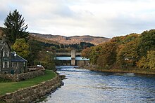
 Pitlochry hydro-electric power station and River Tummel | |
| Country | Scotland |
| Location | Perth and Inverness |
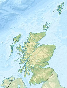
| Coordinates | 56°42′54″N 3°56′20″W / 56.715°N 3.939°W |
| Purpose | Power |
| Status | Operational |
| Construction began | 1928 |
| Opening date | 1933 |
| Owner(s) | SSE |
The Tummel hydro-electric power scheme is an interconnected network of dams, power stations, aqueducts and electric power transmission in the Grampian Mountains of Scotland. Roughly bounded by Dalwhinnie in the north, Rannoch Moor in the west and Pitlochry in the east it comprises a water catchment area of around 1,800 square kilometres (690 square miles)[1] and primary water storage at Loch Ericht, Loch Errochty, Loch Rannoch and Loch Tummel, in Perth and Kinross. Water, depending on where it originates and the path it takes, may pass through as many as five of the schemes nine power stations as it progresses from north-west to south-east.[2] The scheme was constructed in the 1940s and 50s incorporating some earlier sites. It is managed by SSE plc.
- ^ "Updating the floodgates". Water Power Magazine. 3 March 2010. Archived from the original on 13 August 2022. Retrieved 13 June 2021.
- ^ "Kinloch Rannoch Weir, Tummel Valley Scheme". Green energy trail. Archived from the original on 28 July 2021. Retrieved 13 June 2021.
© MMXXIII Rich X Search. We shall prevail. All rights reserved. Rich X Search

