This article needs additional citations for verification. (March 2015) |
| Thurahalli Forest | |
|---|---|
 | |
| Map | |
| Geography | |
| Location | Bengaluru, Karnataka, India |
| Coordinates | 12°52′54″N 77°31′30″E / 12.8816831°N 77.5249823°E |
| Elevation | 888 metres |
| Area | 590 acres |
| Administration | |
| Status | protected, endangered |
| Governing body | Karnataka Forest Department |
| Ecology | |
| Ecosystem(s) | India |
| Disturbance | forest fires, garbage dumping |
| Dominant tree species | Eucalyptus |
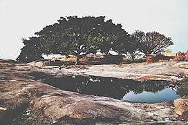
The Thurahalli Forest or Thurahalli Park is a dry and deciduous forest. It is located about 20 km from Bengaluru off Kanakapura Road. It is 13 km from Banashankari and can be overseen from the NICE road. Entry inside the park has been banned for vehicles, however, it has become a hot spot for cyclists.
It has a nice view and a small Shani temple on top of a rocky hill. As of today, Thurahalli forest is said to be Bengaluru's only surviving forest.[1]
Rocks in the forest provide one of the few outdoor bouldering opportunities to the cities residents and have multiple established routes.
- ^ Mohan, Deepa (28 September 2012). "Thurahalli: Bangalore's last forest standing?". The Alternative. Retrieved 29 June 2018.
© MMXXIII Rich X Search. We shall prevail. All rights reserved. Rich X Search

