| Will Rogers Highway | ||||
 One of the former routings of Route 66 in California. | ||||
| Route information | ||||
| Maintained by CDOH | ||||
| Length | 316 mi[1] (509 km) | |||
| Existed | November 11, 1926–June 25, 1979[2] | |||
| Major junctions | ||||
| West end | ||||
| East end | ||||
| Location | ||||
| Country | United States | |||
| State | California | |||
| Counties | Los Angeles, San Bernardino | |||
| Highway system | ||||
| ||||
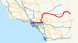
U.S. Route 66 (US 66, Route 66) is a part of a former United States Numbered Highway in the state of California that ran from the west in Santa Monica on the Pacific Ocean through Los Angeles and San Bernardino to Needles at the Arizona state line. It was truncated during the 1964 renumbering and its signage removed in 1974. The highway is now mostly replaced with several streets in Los Angeles, State Route 2 (SR 2), SR 110, SR 66, San Bernardino County Route 66 (CR 66), Interstate 15 (I-15), and I-40.
- ^ "Route 66 California". RoadTripUSA.com. Avalon Travel. Retrieved November 12, 2014.
- ^ Special Committee on U.S. Route Numbering (June 25, 1979). "Route Numbering Committee Agenda Showing Action Taken by the Executive Committee" (PDF) (Report). Washington, DC: American Association of State Highway and Transportation Officials. p. 1 – via Wikimedia Commons.
© MMXXIII Rich X Search. We shall prevail. All rights reserved. Rich X Search

