Back Upolu ANG أوبولو Arabic أوپولو ARY اوبولو ARZ Upolu AST Уполу Byelorussian Upolu BS Upolu Catalan Upolu (pulo sa Samowa) CEB Upolu Czech
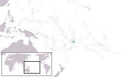
 Map of Samoa showing Upolu at right | |
 | |
| Geography | |
|---|---|
| Location | Pacific Ocean |
| Coordinates | 13°55′S 171°45′W / 13.917°S 171.750°W |
| Area | 1,125 km2 (434 sq mi) |
| Length | 75 km (46.6 mi) |
| Highest elevation | 1,113 m (3652 ft) |
| Highest point | Mount Vaivai[1] |
| Administration | |
Samoa | |
| Largest settlement | Apia (pop. ~35,000) |
| Demographics | |
| Population | 143,418 (2011) |
| Pop. density | 127/km2 (329/sq mi) |
| Ethnic groups | 92.6% Samoans, 7% Euronesians (persons of European and Polynesian blood), 0.4% Europeans |
Upolu is an island in Samoa, formed by a massive basaltic shield volcano which rises from the seafloor of the western Pacific Ocean. The island is 75 kilometres (47 miles) long and 1,125 square kilometres (434 square miles) in area, making it the second largest of the Samoan Islands by area. With approximately 145,000 inhabitants, it is by far the most populous of the Samoan Islands. Upolu is situated to the southeast of Savai'i, the "big island". Apia, the capital, is in the middle of the north coast, and Faleolo International Airport at the western end of the island. The island has not had any historically recorded eruptions, although there is evidence of three lava flows, dating back only to between a few hundred and a few thousand years ago.
In the Samoan branch of Polynesian mythology, Upolu was the first woman on the island.
James Michener based his character Bloody Mary in Tales of the South Pacific (later a major character in the Rodgers and Hammerstein musical, South Pacific) on the owner of Aggie Grey's Hotel on the south end of the island. She was still running the hotel in 1960. A branch was later opened in Apia, overlooking the harbor.
- ^ Fuimaono Lumepa Hald (13 May 2022). "Mt. Fito not the highest point in Upolu". Samoa Observer. Retrieved 14 May 2022.
© MMXXIII Rich X Search. We shall prevail. All rights reserved. Rich X Search