Back Upper Providence Township (Delaware County, Pensilvania) German Municipio de Upper Providence (condado de Delaware) Spanish آپر پراویدنس تاونشیپ، شهرستان دلاویر، پنسیلوانیا Persian Upper Providence Township French Upper Providence Township Dutch Upper Providence Township Portuguese Upper Providence Township, Pennsylvania Serbo-Croatian Апер Провиденс Тауншип (Пенсилванија) Serbian Аппер-Провіденс Тауншип (округ Делавер, Пенсільванія) Ukrainian Upper Providence Township Uzbek
Upper Providence Township | |
|---|---|
 | |
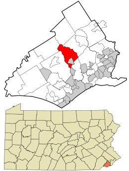
 Location in Delaware County and the state of Pennsylvania. | |
 Location of Pennsylvania in the United States | |
| Coordinates: 39°56′31″N 75°23′47″W / 39.94194°N 75.39639°W | |
| Country | United States |
| State | Pennsylvania |
| County | Delaware |
| Area | |
| • Total | 5.81 sq mi (15.05 km2) |
| • Land | 5.60 sq mi (14.51 km2) |
| • Water | 0.21 sq mi (0.54 km2) |
| Elevation | 330 ft (100 m) |
| Population (2010) | |
| • Total | 10,142 |
| • Estimate (2016)[2] | 10,446 |
| • Density | 1,864.36/sq mi (719.78/km2) |
| FIPS code | 42-045-79248 |
| Website | www |
Upper Providence Township is a township in Delaware County, Pennsylvania, United States, located around and to the north of the borough of Media, and approximately 15 miles (24 km) west of center city Philadelphia. The population was 10,142 at the 2010 census.[3] The township lies between Ridley Creek on the west and Crum Creek on the east. Most of Ridley Creek State Park is in the township, towards the northern edge. Zoning is 98% residential, 1% commercial and 1% industrial, with minimal space zoned to commercial business.[4]
- ^ "2016 U.S. Gazetteer Files". United States Census Bureau. Retrieved Aug 13, 2017.
- ^ "Population and Housing Unit Estimates". Retrieved June 9, 2017.
- ^ "U.S. Census Bureau - 2010 Demographic Profile Data" (PDF). Archived from the original (PDF) on 2012-02-09. Retrieved 2012-11-27.
- ^ Upper Providence Township Archived 2014-03-04 at the Wayback Machine miscellaneous
© MMXXIII Rich X Search. We shall prevail. All rights reserved. Rich X Search