Back Val-des-Bois CEB Val-des-Bois (Quebec) Basque وال-ده-بووا، کبک Persian Val-des-Bois French Val-des-Bois Swedish
Val-des-Bois | |
|---|---|
 Municipal office | |
 Location within Papineau RCM | |
| Coordinates: 45°55′N 75°36′W / 45.917°N 75.600°W[1] | |
| Country | Canada |
| Province | Quebec |
| Region | Outaouais |
| RCM | Papineau |
| Constituted | January 1, 1885 |
| Government | |
| • Mayor | Roland Montpetit |
| • Federal riding | Argenteuil—Papineau—Mirabel |
| • Prov. riding | Papineau |
| Area | |
| • Total | 245.60 km2 (94.83 sq mi) |
| • Land | 222.67 km2 (85.97 sq mi) |
| Population (2021)[3] | |
| • Total | 920 |
| • Density | 4.1/km2 (11/sq mi) |
| • Pop 2016–2021 | |
| • Dwellings | 837 |
| Time zone | UTC−5 (EST) |
| • Summer (DST) | UTC−4 (EDT) |
| Postal code(s) | |
| Area code | 819 |
| Highways | |
| Website | www |
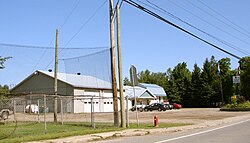
Val-des-Bois is a town and municipality in the Papineau Regional County Municipality in the Outaouais region of Quebec, Canada. The town is located on the eastern shores of the Du Lièvre River, 47 kilometers (29 mi) north of Buckingham.
The main local economic activity depends on cottage tourism.[4] The eastern half of the municipality is part of the Papineau-Labelle Wildlife Reserve.
- ^ Cite error: The named reference
toponymiewas invoked but never defined (see the help page). - ^ a b Cite error: The named reference
mamrotwas invoked but never defined (see the help page). - ^ a b Cite error: The named reference
cp21was invoked but never defined (see the help page). - ^ Cite error: The named reference
CTQ-VdBwas invoked but never defined (see the help page).
© MMXXIII Rich X Search. We shall prevail. All rights reserved. Rich X Search
