Back Verde Island (pulo sa Pilipinas) CEB Verde Island German Isla Verde (Filipinas) Spanish Đảo Verde Vietnamese
Native name: Pulo ng Verde | |
|---|---|
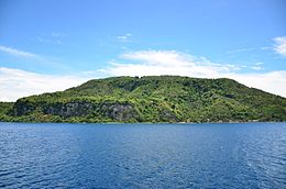
 View of the Island | |
| Geography | |
| Location | Verde Island Passage |
| Coordinates | 13°32′59″N 121°4′15″E / 13.54972°N 121.07083°E |
| Highest elevation | 300 m (1000 ft) |
| Highest point | Liponpon Peak |
| Administration | |
| Region | Calabarzon |
| Province | Batangas |
| City | Batangas City |
| Barangays |
|
| Demographics | |
| Population | 5,075 (as of 2020) |
| Ethnic groups | Tagalogs |
| Additional information | |
 | |
Verde Island is a volcanic island situated along the bodies of Verde Island Passage between the islands of Luzon and Mindoro, Philippines. It was in 1988 when a small village was connected to mains electricity through the effort of a European project using technologies such as solar panels for the island's self-sufficiency. Since then, it has been declared by the Philippine Tourism Authority as one of the country's marine reserves.[1][2]
© MMXXIII Rich X Search. We shall prevail. All rights reserved. Rich X Search
