Back فيرنال Arabic فيرنال ARZ ورنال، یوتا AZB Вернал (Юта) Byelorussian Вэрнал (Юта) BE-X-OLD Върнал Bulgarian Vernal Catalan Вернел (Юта) CE Vernal CEB Vernal (Utah) Czech
Vernal, Utah | |
|---|---|
 East entrance of Vernal (2012) | |
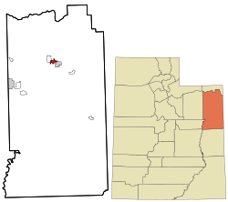
 Location within Uintah County and Utah | |
| Coordinates: 40°27′17″N 109°32′8″W / 40.45472°N 109.53556°W | |
| Country | United States |
| State | Utah |
| County | Uintah |
| Settled | 1876 |
| Named for | Vernal |
| Government | |
| • Mayor | Doug Hammond as of January 2018[update][1] |
| Area | |
| • Total | 4.62 sq mi (11.97 km2) |
| • Land | 4.62 sq mi (11.97 km2) |
| • Water | 0.00 sq mi (0.00 km2) |
| Elevation | 5,328 ft (1,624 m) |
| Population (2020) | |
| • Total | 10,079 |
| • Estimate (2022) | 10,432 |
| • Density | 2,180.7/sq mi (871.95/km2) |
| Time zone | UTC−7 (Mountain (MST)) |
| • Summer (DST) | UTC−6 (MDT) |
| ZIP codes | 84078-84079 |
| Area code | 435 |
| FIPS code | 49-80090[3] |
| GNIS feature ID | 1433885[4] |
| Website | vernalcity.org |
Vernal, the county seat and largest city in Uintah County, is in northeastern Utah, approximately 175 miles (280 km) east of Salt Lake City and 20 miles (32 km) west of the Colorado border.[5] As of the 2020 census, the city population was 10,079. The population has since grown to 10,432 as of the 2022 population estimate.[6]
Vernal is home to the Vernal Temple of The Church of Jesus Christ of Latter-day Saints and one of the nine statewide regional campuses of Utah State University. The city serves as a gateway to the nearby Dinosaur National Monument, Flaming Gorge, and the Uintah Mountain Range.
- ^ "Vernal, Utah". CNNMoney. March 19, 2013. Retrieved March 20, 2013.
- ^ "2019 U.S. Gazetteer Files". United States Census Bureau. Retrieved August 7, 2020.
- ^ "U.S. Census website". United States Census Bureau. Retrieved January 31, 2008.
- ^ "US Board on Geographic Names". United States Geological Survey. October 25, 2007. Retrieved January 31, 2008.
- ^ "Find a County". National Association of Counties. Archived from the original on May 31, 2011. Retrieved June 7, 2011.
- ^ "QuickFacts: Vernal city, Utah". U.S. Census Bureau. Retrieved December 26, 2023.
© MMXXIII Rich X Search. We shall prevail. All rights reserved. Rich X Search