Back وارومبونغل Arabic Warrumbungle Range (kabukiran sa Ostralya) CEB Warrumbungle Range German Warrumbungles Spanish Warrumbungles Estonian Warrumbungle Range Polish Warrumbungles Swedish
| Warrumbungles | |
|---|---|
 Completing a circuit around the jagged Breadknife is a steep hike taking about five hours. | |
| Highest point | |
| Peak | Mount Exmouth |
| Elevation | 1,206 m (3,957 ft) |
| Geography | |
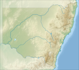
Location of the Warrumbungle Range in New South Wales | |
| Country | Australia |
| State | New South Wales |
| Range coordinates | 31°12′S 148°54′E / 31.200°S 148.900°E |
| Geology | |
| Formed by | Shield volcano |
| Age of rock | Cenozoic |
The Warrumbungles is a mountain range in the Orana region of New South Wales, Australia. The nearest town is Coonabarabran. The area is easiest accessed from the Newell Highway which is the major road link directly between Melbourne, Victoria and Brisbane, Queensland and cuts across inland New South Wales from the north to the south.
As the range is between the moist eastern coastal zone and the dryer plains to the west, it has provided protection for flora and fauna suited to both habitats. There are over 120 bird species identified on the range, including lories and lorikeets, rosellas and parrots. The centre of the range has served as an area of protection for a healthy and content colony of grey kangaroos. These animals have become fairly tame due to constant visitor attention and are easily approached.
The Siding Spring Observatory is located on Mount Woorut, an eastern peak. The area has little to no light pollution to disturb astronomical viewing. In 2016, the International Dark-Sky Association declared the Warrumbungle National Park as Australia's first International Dark Sky Park.
The Warrumbungles hosted the 2006 World Rogaining Championships.
© MMXXIII Rich X Search. We shall prevail. All rights reserved. Rich X Search
