Back مقاطعة واشتيناو (ميشيغان) Arabic Washtenaw County, Michigan BAR Уоштъно (окръг, Мичиган) Bulgarian ৱাসটেনাউ কাউন্টি, মিশিগান BPY Washtenaw Gông (Michigan) CDO Washtenaw County CEB Washtenaw County Czech Washtenaw County, Michigan Welsh Washtenaw County German Kantono Vaŝtenavo Esperanto
Washtenaw County | |
|---|---|
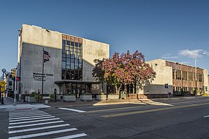
 Washtenaw County Courthouse | |
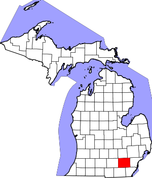
 Location within the U.S. state of Michigan | |
 Michigan's location within the U.S. | |
| Coordinates: 42°15′N 83°50′W / 42.25°N 83.84°W | |
| Country | |
| State | |
| Founded | 1822 (created) 1826 (organized)[1][2] |
| Named for | O-wash-ta-nong ("far away water"), Ojibwe name for the Grand River |
| Seat | Ann Arbor |
| Largest city | Ann Arbor |
| Area | |
| • Total | 722 sq mi (1,870 km2) |
| • Land | 706 sq mi (1,830 km2) |
| • Water | 16 sq mi (40 km2) 2.3% |
| Population (2020) | |
| • Total | 372,258 |
| • Density | 527/sq mi (203/km2) |
| Time zone | UTC−5 (Eastern) |
| • Summer (DST) | UTC−4 (EDT) |
| Congressional district | 6th |
| Website | washtenaw |
Washtenaw County (/ˈwɔːʃtənɔː/ WASH-tə-naw) is a county located in the U.S. state of Michigan. At the 2020 census, the population was 372,258.[3] The county seat and largest city is Ann Arbor.[4] The county was authorized by legislation in 1822 and organized as a county in 1826.[1] Washtenaw County comprises the Ann Arbor Metropolitan Statistical Area. The county is home to the University of Michigan, Eastern Michigan University, Washtenaw Community College, and Concordia University Ann Arbor.
- ^ a b "Bibliography on Washtenaw County". Clarke Historical Library, Central Michigan University. Archived from the original on October 6, 2014. Retrieved January 23, 2013.
- ^ "About —". ewashtenaw.org. Archived from the original on October 28, 2012. Retrieved June 16, 2006.
- ^ "US Census QuickFacts". US Census Bureau. Retrieved August 13, 2021.
- ^ "Find a County". National Association of Counties. Archived from the original on May 31, 2011. Retrieved June 7, 2011.
© MMXXIII Rich X Search. We shall prevail. All rights reserved. Rich X Search
