Back مقاطعة وين (أوهايو) Arabic واین بؤلگهسی، اوهایو AZB Wayne County, Ohio BAR Уейн (окръг, Охайо) Bulgarian ৱাইনে কাউন্টি, ওহাইও BPY Wayne Gông (Ohio) CDO Wayne County (kondado sa Tinipong Bansa, Ohio) CEB Wayne County, Ohio Welsh Wayne County (Ohio) Danish Wayne County (Ohio) German
Wayne County | |
|---|---|
 The Wayne County Courthouse in September 2004 | |
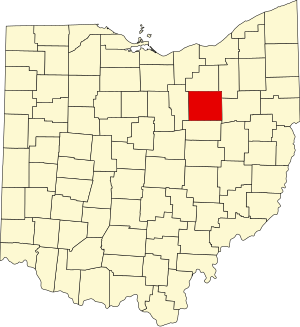
 Location within the U.S. state of Ohio | |
 Ohio's location within the U.S. | |
| Coordinates: 40°50′N 81°53′W / 40.83°N 81.89°W | |
| Country | |
| State | |
| Founded | January 4, 1812 (date organized; formed 1808)[1] |
| Named for | General Anthony Wayne |
| Seat | Wooster |
| Largest city | Wooster |
| Area | |
| • Total | 557 sq mi (1,440 km2) |
| • Land | 555 sq mi (1,440 km2) |
| • Water | 1.9 sq mi (5 km2) 0.3% |
| Population (2020) | |
| • Total | 116,894 |
| • Estimate (2022)[2] | 116,559 |
| • Density | 210/sq mi (81/km2) |
| Time zone | UTC−5 (Eastern) |
| • Summer (DST) | UTC−4 (EDT) |
| Congressional district | 7th |
| Website | www |
Wayne County is a county in the U.S. state of Ohio. As of the 2020 census, the population was 116,894.[3] Its county seat is Wooster.[4] The county is named for General "Mad" Anthony Wayne.[5] Wayne County comprises the Wooster, OH Micropolitan Statistical Area.
- ^ "Wayne County History". Wayne County Public Library. Archived from the original on March 22, 2013. Retrieved June 12, 2012.
- ^ "QuickFacts: Wayne County, Ohio". Census.gov. Retrieved May 29, 2022.
- ^ 2020 census
- ^ "Find a County". National Association of Counties. Retrieved June 7, 2011.
- ^ Goodman, Rebecca (2005). This Day in Ohio History. Emmis Books. p. 119. ISBN 9781578601912. Retrieved November 21, 2013.
© MMXXIII Rich X Search. We shall prevail. All rights reserved. Rich X Search

