Back ويسترفيل (أوهايو) Arabic ويستيرفيل ARZ وسترویل، اوهایو AZB Westerville Catalan Вестервилл (Огайо) CE Westerville CEB Westerville, Ohio Welsh Westerville (Ohio) German Westerville (Ohio) Spanish Westerville (Ohio) Basque
Westerville, Ohio | |
|---|---|
 State Street in Westerville | |
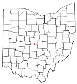
 Location of Westerville in Ohio | |
 Location of Westerville in Franklin County | |
| Coordinates: 40°07′50″N 82°55′22″W / 40.13056°N 82.92278°W | |
| Country | United States |
| State | Ohio |
| Counties | Delaware, Franklin |
| Incorporated | 1858 |
| Area | |
| • Total | 12.74 sq mi (33.00 km2) |
| • Land | 12.60 sq mi (32.64 km2) |
| • Water | 0.14 sq mi (0.36 km2) |
| Elevation | 879 ft (268 m) |
| Population (2020) | |
| • Total | 39,190 |
| • Density | 3,109.82/sq mi (1,200.74/km2) |
| Time zone | UTC-5 (EST) |
| • Summer (DST) | UTC-4 (EDT) |
| ZIP codes | 43081, 43082, 43086[3] |
| Area code(s) | 614 and 380 |
| FIPS code | 39-83342 |
| GNIS feature ID | 1086118[2] |
| Website | www |

Westerville is a city in Franklin and Delaware counties in the U.S. state of Ohio. A northeastern suburb of Columbus as well as the home of Otterbein University, the population was 39,190 at the 2020 census.
Westerville was once known as "The Dry Capital of the World" for its strict laws prohibiting sales of alcohol and for being the home of the Anti-Saloon League, one of the driving forces behind Prohibition at the beginning of the 20th century.
- ^ "ArcGIS REST Services Directory". United States Census Bureau. Retrieved September 20, 2022.
- ^ a b U.S. Geological Survey Geographic Names Information System: Westerville, Ohio
- ^ "Westerville Zip Code Search Results". Retrieved September 19, 2007.
© MMXXIII Rich X Search. We shall prevail. All rights reserved. Rich X Search