Back مقاطعة ويندهام (كونيتيكت) Arabic Condáu de Windham (Connecticut) AST Windham County, Connecticut BAR Уиндъм (окръг, Кънектикът) Bulgarian ৱয়িন্ডহাম কাউন্টি, কানেকটিকাট BPY Windham Gông (Connecticut) CDO Уиндем (гуо, Коннектикут) CE Windham County (kondado sa Tinipong Bansa, Connecticut) CEB Windham County, Connecticut Welsh Windham County (Connecticut) German
Windham County | |
|---|---|
 Windham Town Hall, a former county courthouse | |
 Location within the U.S. state of Connecticut | |
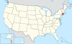
 Connecticut's location within the U.S. | |
| Coordinates: 41°50′N 71°59′W / 41.83°N 71.99°W | |
| Country | |
| State | |
| Founded | May 12, 1726 |
| Named for | Windham, England |
| Seat | none (1960-present)
Willimantic (1893–1960) Windham Center (1726–1893) |
| Largest town | Windham |
| Area | |
| • Total | 521 sq mi (1,350 km2) |
| • Land | 513 sq mi (1,330 km2) |
| • Water | 8.5 sq mi (22 km2) 1.6% |
| Population (2020) | |
| • Total | 116,418 |
| • Density | 223.5/sq mi (86.3/km2) |
| Time zone | UTC−5 (Eastern) |
| • Summer (DST) | UTC−4 (EDT) |
| Area code | 860 and 959 |
| Congressional district | 2nd |
Windham County (/ˈwɪndəm/ WIN-dəm) is one of the eight historical counties in the U.S. state of Connecticut, located in its northeastern corner. As of the 2020 census, the population was 116,418,[1] making it the least populous county in Connecticut. It forms the core of the region known as the Quiet Corner. Windham County is included in the Worcester, MA-CT Metropolitan Statistical Area, which is also included in the Boston-Worcester-Providence, MA-RI-NH-CT Combined Statistical Area. The entire county is within the Quinebaug and Shetucket Rivers Valley National Heritage Corridor, as designated by the National Park Service.
- ^ "Census - Geography Profile: Windham County, Connecticut". United States Census Bureau. Retrieved November 20, 2021.
© MMXXIII Rich X Search. We shall prevail. All rights reserved. Rich X Search
