Back مقاطعة وندسور (فيرمونت) Arabic Condáu de Windsor AST ویندزور بؤلگهسی، ورمونت AZB Windsor County, Vermont BAR Уиндзър (окръг, Вермонт) Bulgarian ৱিন্ডসর কাউন্টি, ভার্মন্ট BPY Windsor Gông (Vermont) CDO Уинсор (гуо, Вермонт) CE Windsor County CEB Windsor County, Vermont Welsh
Windsor County | |
|---|---|
 Windsor County courthouse in Woodstock | |
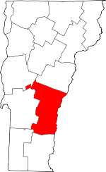
 Location within the U.S. state of Vermont | |
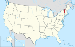
 Vermont's location within the U.S. | |
| Coordinates: 43°33′30″N 72°31′59″W / 43.55827°N 72.53299°W | |
| Country | |
| State | |
| Founded | 1781 |
| Named for | Windsor, Vermont, which was named for Windsor, Connecticut |
| Shire Town | Woodstock |
| Largest town | Hartford |
| Area | |
| • Total | 977 sq mi (2,530 km2) |
| • Land | 969 sq mi (2,510 km2) |
| • Water | 7.4 sq mi (19 km2) 0.8% |
| Population (2020) | |
| • Total | 57,753 |
| • Density | 59/sq mi (23/km2) |
| Time zone | UTC−5 (Eastern) |
| • Summer (DST) | UTC−4 (EDT) |
| Congressional district | At-large |
Windsor County is a county located in the U.S. state of Vermont. As of the 2020 census, the population was 57,753.[1] The shire town (county seat) is the town of Woodstock.[2] The county's largest municipality is the town of Hartford.
- ^ "State & County QuickFacts". United States Census Bureau. Retrieved October 28, 2021.
- ^ "Find a County". National Association of Counties. Retrieved June 7, 2011.
© MMXXIII Rich X Search. We shall prevail. All rights reserved. Rich X Search