Back Voleai adası Azerbaijani Woleai CEB Woleai German Woleai Spanish ولئای Persian Woleai Finnish Woleai French Woleai Italian ウォレアイ環礁 Japanese 월레아이 환초 Korean
 NASA picture of Woleai Atoll | |
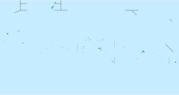
 Map of Woleai | |
| Geography | |
|---|---|
| Location | North Pacific |
| Coordinates | 7°22′N 143°54′E / 7.367°N 143.900°E |
| Archipelago | Caroline |
| Total islands | 18 |
| Area | 4.5 km2 (1.7 sq mi) |
| Highest elevation | 2 m (7 ft) |
| Administration | |
| State | Yap |
| Demographics | |
| Population | 1081 (2000) |
| Ethnic groups | Micronesian |
Woleai, also known as Oleai,[1] is a coral atoll of 22 islands in the western Caroline Islands in the Pacific Ocean, forming a legislative district in the Yap State in the Federated States of Micronesia, and located approximately 57 kilometers (35 mi; 31 nmi) west-northwest of Ifalik and 108 kilometers (67 mi; 58 nmi) northeast of Eauripik. Woleai is also the name of the largest of the islets constituting the atoll, lying to the northeast.
The population of the atoll was 1,081 in 2000,[2] on an area of 4.5 km2.
- ^ "Report of the German South Pacific Expedition 1908-1910" (PDF). Translated by Petrosian-Husa, Carmen C. H. 2001. Archived from the original (PDF) on 26 April 2012.
- ^ Yap State Census Report, 2000 (PDF)
© MMXXIII Rich X Search. We shall prevail. All rights reserved. Rich X Search
