Back ورلاند Arabic ورلاند ARZ وورلاند، ویومینق AZB Уорленд Bulgarian Worland Catalan Ворленд CE Worland CEB Worland CH Worland, Wyoming Welsh Worland Danish
Worland, Wyoming | |
|---|---|
 Aerial view of Worland, August 2011 | |
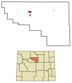
 Location of Worland in Washakie County, Wyoming. | |
| Coordinates: 44°1′0″N 107°57′30″W / 44.01667°N 107.95833°W | |
| Country | United States |
| State | Wyoming |
| County | Washakie |
| Settled | 1900 |
| Incorporated | 1906 |
| Government | |
| • Mayor | Jim Gill |
| Area | |
| • Total | 4.64 sq mi (12.02 km2) |
| • Land | 4.59 sq mi (11.88 km2) |
| • Water | 0.06 sq mi (0.14 km2) 1.72% |
| Elevation | 4,065 ft (1,239 m) |
| Population | |
| • Total | 4,773 |
| • Estimate (2023)[3] | 4,785 |
| • Density | 1,095.27/sq mi (422.89/km2) |
| Time zone | UTC−7 (Mountain) |
| • Summer (DST) | UTC−6 (Mountain) |
| ZIP code | 82401 |
| Area code | 307 |
| FIPS code | 56-84925[4] |
| GNIS feature ID | 1596624[5] |
| Website | www |
Worland is a city in Washakie County, Wyoming, United States. The population was 4,773 at the 2020 census, down from 5,487 at the 2010 census. It is the county seat of Washakie County.[6] It is located within the Big Horn Basin and along the Big Horn River in northwestern Wyoming.
- ^ "2019 U.S. Gazetteer Files". United States Census Bureau. Retrieved August 7, 2020.
- ^ Cite error: The named reference
wwwcensusgovwas invoked but never defined (see the help page). - ^ "Population and Housing Unit Estimates". United States Census Bureau. May 24, 2020. Retrieved May 27, 2020.
- ^ "U.S. Census website". United States Census Bureau. Retrieved January 31, 2008.
- ^ "US Board on Geographic Names". United States Geological Survey. October 25, 2007. Retrieved January 31, 2008.
- ^ "Find a County". National Association of Counties. Archived from the original on May 31, 2011. Retrieved June 7, 2011.
© MMXXIII Rich X Search. We shall prevail. All rights reserved. Rich X Search
