Back ያቫፓይ ካውንቲ፥ አሪዞና Amharic مقاطعة يافاباي (أريزونا) Arabic Yavapai County, Arizona BAR Явапай (окръг) Bulgarian ইয়াবাপাই কাউন্টি, অ্যারিজোনা BPY Yavapai Gông (Arizona) CDO Явапаи (гуо, Аризона) CE Yavapai County CEB Yavapai County Czech Yavapai County, Arizona Welsh
Yavapai County | |
|---|---|
 Yavapai County Courthouse in Prescott | |
 Location within the U.S. state of Arizona | |
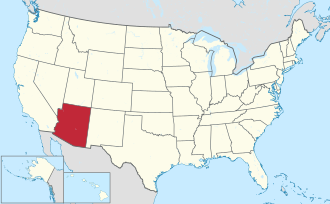
 Arizona's location within the U.S. | |
| Coordinates: 34°33′41″N 112°32′24″W / 34.56139°N 112.54000°W | |
| Country | |
| State | |
| Founded | November 9, 1864 |
| Named after | Yavapai people |
| Seat | Prescott |
| Largest city | Prescott Valley |
| Area | |
• Total | 8,128 sq mi (21,050 km2) |
| • Land | 8,123 sq mi (21,040 km2) |
| • Water | 4.4 sq mi (11 km2) 0.05% |
| Population (2020) | |
• Total | 236,209 |
• Estimate (2023) | 249,081 |
| • Density | 29/sq mi (11/km2) |
| Time zone | UTC−7 (Mountain) |
| Congressional district | 2nd |
| Website | yavapaiaz |
Yavapai County (/ˈjævəˌpaɪˌ/ YA-və-pye) is a county near the center of the U.S. state of Arizona. As of the 2020 census, its population was 236,209,[1] making it the fourth-most populous county in Arizona. The county seat is Prescott.[2]
Yavapai County comprises the Prescott Valley-Prescott, AZ Metropolitan Statistical Area as well as the northern portions of Peoria and Wickenburg, the balance of which are in the Phoenix Metropolitan Area.
- ^ "State & County QuickFacts". United States Census Bureau. Retrieved September 27, 2022.
- ^ "Find a County". National Association of Counties. Archived from the original on May 31, 2011. Retrieved June 7, 2011.
© MMXXIII Rich X Search. We shall prevail. All rights reserved. Rich X Search

