York Street | |
|---|---|
 | |
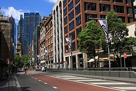
| Looking south down York Street, near Druitt Street | |
 | |
| Coordinates | |
| General information | |
| Type | Street |
| Length | 1.05 km (0.7 mi)[1] |
| Former route number | |
| Major junctions | |
| North end | Grosvenor Street Bradfield Highway The Rocks, Sydney |
| |
| South end | Druitt Street Sydney CBD |
| Location(s) | |
| Suburb(s) | Sydney CBD |
| ---- | |
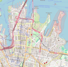
York Street is a street in the Sydney central business district in New South Wales, Australia. York Street runs 1.050 kilometres (0.652 mi)[1] in a north to south direction only and is used predominantly by buses from the northern districts of Sydney.
- ^ a b Western Distributor & York St & Grosvenor St, New South Wales 2000 to 145 York St, Sydney NSW 2000 (Map). Google Maps. 2016. Retrieved 26 December 2016.
© MMXXIII Rich X Search. We shall prevail. All rights reserved. Rich X Search

