Back مطار يوما الدولى ARZ Aeropuertu Internacional de Yuma AST Yuma International Airport CEB Aeropuerto Internacional de Yuma Spanish فرودگاه بینالمللی یوما Persian Tó Ntsʼósíkooh Biih Yílį́įdi tó wónaanídę́ę́ʼ chidí naatʼaʼí ńdinibįįhígi NV Aeroportul Yuma Romanian Фурудгоҳи биналмилалӣ юмо Tajik یوما انٹرنیشنل ہوائی اڈا Urdu
Yuma International Airport | |||||||||||||||||||||||
|---|---|---|---|---|---|---|---|---|---|---|---|---|---|---|---|---|---|---|---|---|---|---|---|
 | |||||||||||||||||||||||
 Aerial view | |||||||||||||||||||||||
| Summary | |||||||||||||||||||||||
| Airport type | Public/military | ||||||||||||||||||||||
| Owner | US Navy | ||||||||||||||||||||||
| Operator | Yuma County Airport Authority and USMC | ||||||||||||||||||||||
| Serves | Yuma, Arizona | ||||||||||||||||||||||
| Hub for | AeroCare | ||||||||||||||||||||||
| Elevation AMSL | 213 ft / 65 m | ||||||||||||||||||||||
| Coordinates | 32°39′24″N 114°36′22″W / 32.65667°N 114.60611°W | ||||||||||||||||||||||
| Website | FlyYuma.com | ||||||||||||||||||||||
| Maps | |||||||||||||||||||||||
 FAA airport diagram | |||||||||||||||||||||||
| Runways | |||||||||||||||||||||||
| |||||||||||||||||||||||
| Statistics (2021) | |||||||||||||||||||||||
| |||||||||||||||||||||||
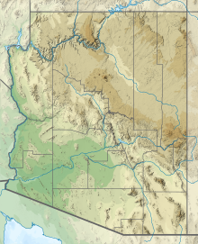
Yuma International Airport (IATA: YUM, ICAO: KNYL, FAA LID: NYL) is a joint use airport with civilian and military flight activity operated in conjunction with the U.S. Marine Corps via the Marine Corps Air Station Yuma. The airfield is located 3.5 miles (3.0 nmi; 5.6 km) south of the central business district of Yuma, a city in Yuma County, Arizona, United States, and 150 miles (130 nmi; 240 km) east of San Diego International Airport.[1] It is mostly used for military aviation, but is also served by one commercial airline and one aeromedical Medevac company as well as being used for general aviation activities.
Although many U.S. airports use the same three-letter location identifier for the Federal Aviation Administration (FAA) and International Air Transport Association (IATA), this airport is assigned NYL by the FAA and YUM by the IATA (which has not assigned NYL to any airport). The airport's International Civil Aviation Organization (ICAO) identifier is KNYL.
- ^ a b FAA Airport Form 5010 for NYL PDF, effective July 31, 2008
© MMXXIII Rich X Search. We shall prevail. All rights reserved. Rich X Search

